I have a raster image(TIFF file). I want to import it to Postgis.
How can I do?
I tried it : - Reader: read tiff file , - Writer: PostGIS Raster.
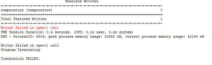
But I got error. Could you tell me please how can I do?
Thank you


 +5
+5
I have a raster image(TIFF file). I want to import it to Postgis.
How can I do?
I tried it : - Reader: read tiff file , - Writer: PostGIS Raster.
But I got error. Could you tell me please how can I do?
Thank you

 +17
+17
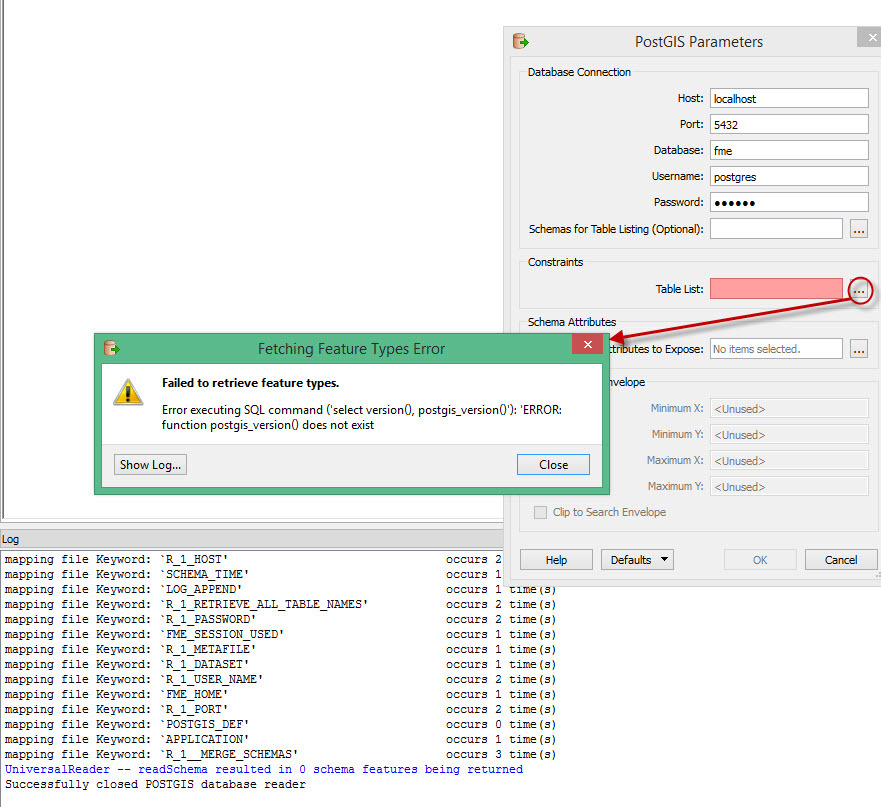
Paste all the error messages.
+17
If you are using pgAdmin III tool, the way described in this page would be a quickest one.
Creating a spatial database (http://www.amipci.org.mx:8080/opengeo-docs/dataadmin/pgGettingStarted/createdb.html)
+5
+5
Could you tell me how can I do? Thanks
+17
What kind of result do you expect?
+5
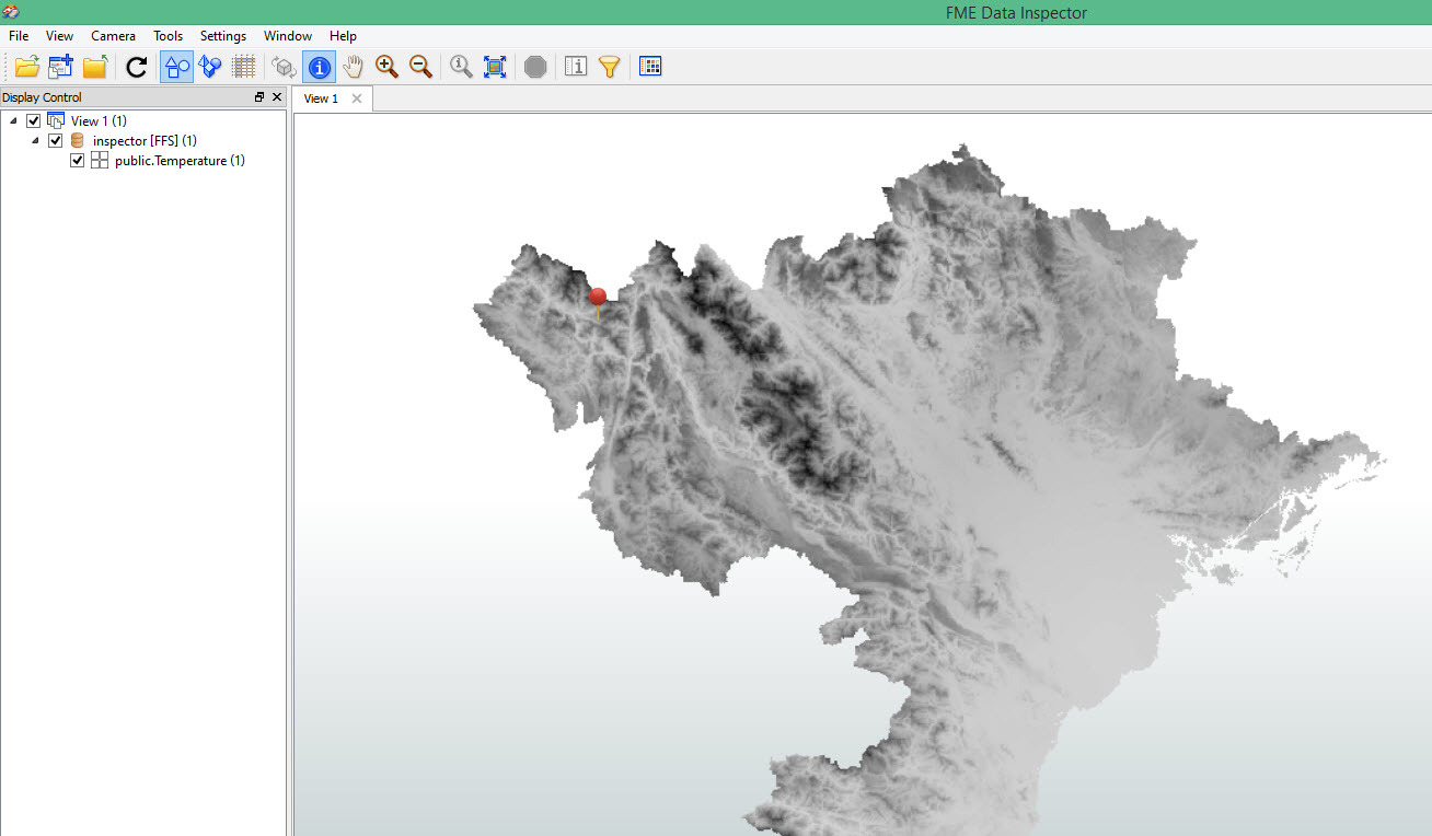
I am connecting temperature image to Postgis.
When I connected, I check in inspector. I saw It has not value.
When I connect postgis to QGIS. I cant open this raster.
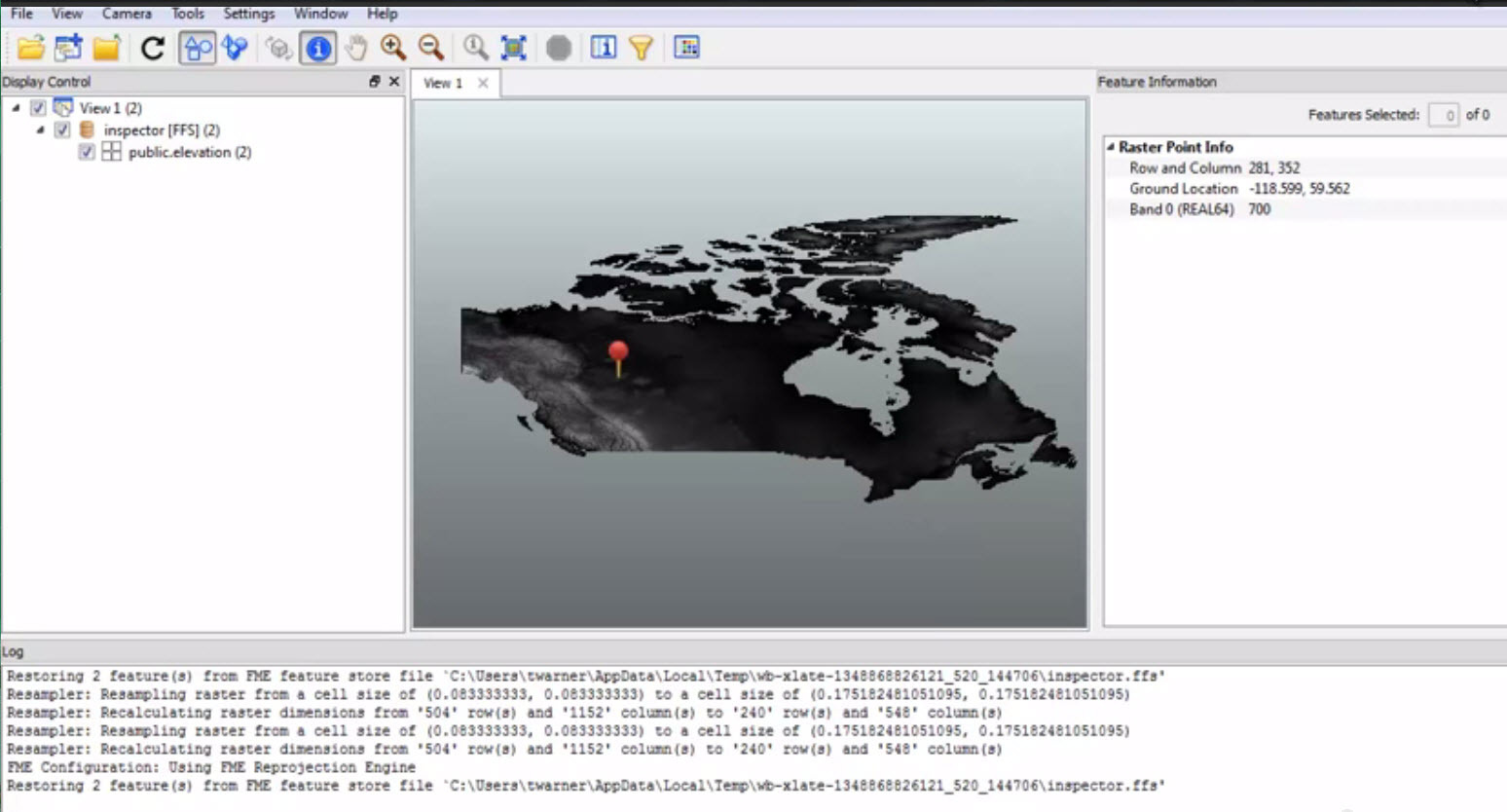
I saw in this example, it has Value of each pixel:
+17
Just one example. If the data consists of points each of which has temperature as its attribute, this process might work as expected.
1) Assign temperature into z-coordinate for each point (3DForcer).
2) Create a DEM raster based on the points (RasterDEMGenerator).
3) Clip the raster by the interest area (Clipper).
4) Write the raster into the database.
+5
Enter your username or e-mail address. We'll send you an e-mail with instructions to reset your password.