
Hello!
I have to transform a PointCloud Dataset (LAS) from EPSG 31256 to EPSG 4326.
Therefore I used the transformer CSMapReprojector. My output PointCloud always looks like this:
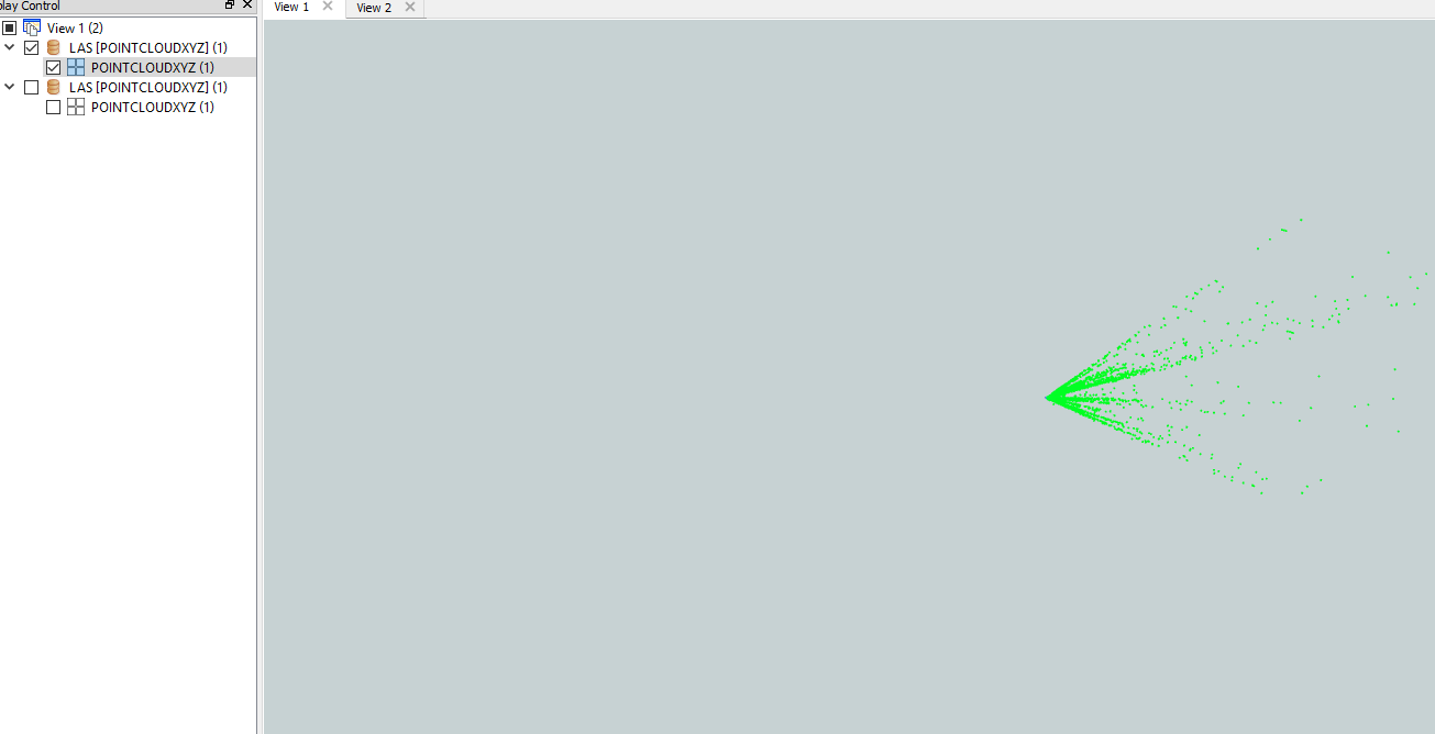
This was the Input dataset:
Thanks for your suggestions.

Hello!
I have to transform a PointCloud Dataset (LAS) from EPSG 31256 to EPSG 4326.
Therefore I used the transformer CSMapReprojector. My output PointCloud always looks like this:
This was the Input dataset:
Thanks for your suggestions.

 +17
+17
The units of x, y coordinates in EPSG 31256 are meters, whereas the units in EPSG 4326 are degrees. I think the difference in the units of x, y coordinates causes such a strange (but correct I think) result.
Thank you for the hint @takashi. I think the Problem is laying in the vertical Transformation (heigts) from EPSG 31256 to EPSG 4326. I now started using the CSMapReprojector instead of the Reprojector to also define the vertical handling. (which is by Default "Ignore height and leave them unchanged") @daveatsafe Do you maybe know which vertical handling I can use for the reprojection of a PointCloud from MGI GK East to WGS84?
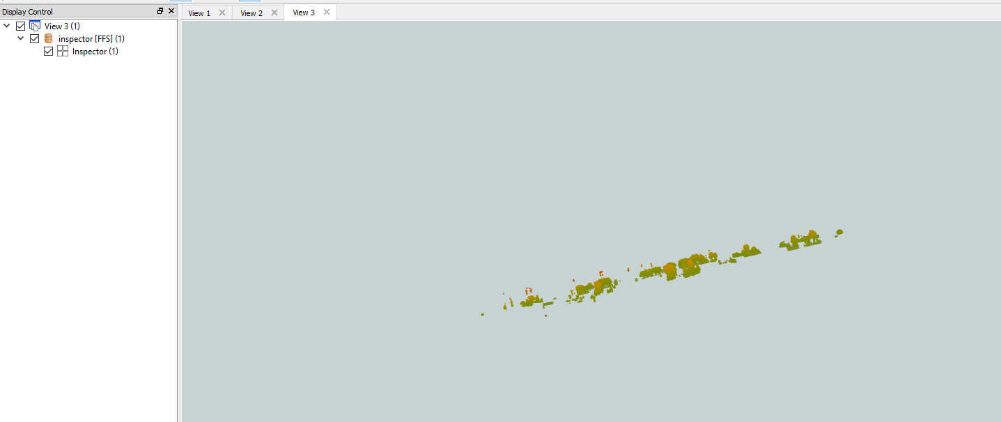
I tried a las file (I set projection ex. 31256 at reader and 4326 at writer). it is working but there is a problem with the inspector. I opened the result with globalMapper and it is correct. Tr to open the result with another software.
+17
I tried a las file (I set projection ex. 31256 at reader and 4326 at writer). it is working but there is a problem with the inspector. I opened the result with globalMapper and it is correct. Tr to open the result with another software.
The 3D renderer of FME Data Inspector doesn't support reprojecting on the fly, so I think it's natural that 3D objects looks strangely on the View if the units of z-coordinate are different from the units of x, y-coordinates.
Enter your username or e-mail address. We'll send you an e-mail with instructions to reset your password.
