Question

result


Badge

Hello,

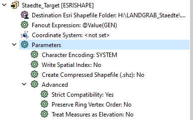
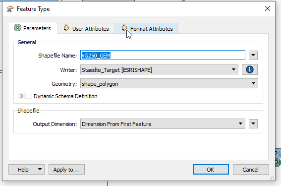
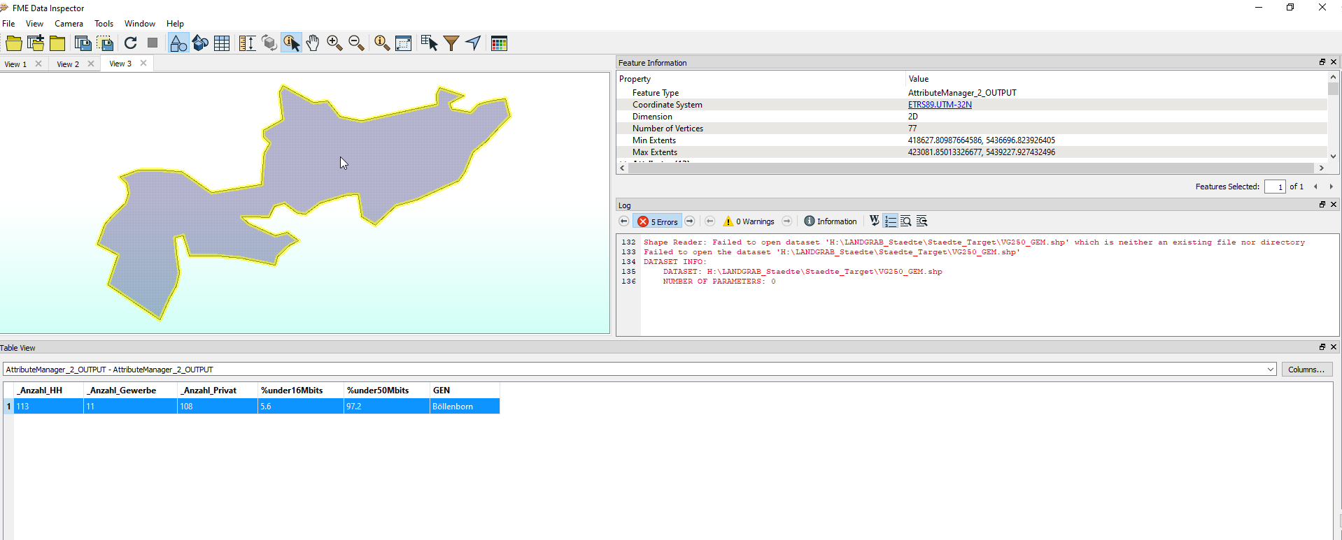
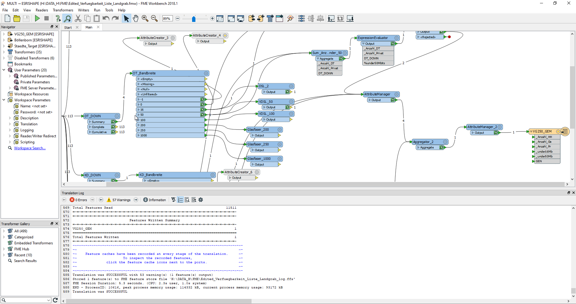
I tried to add attributes from Esri File (Points-at the end it were no Points, just attributes = sum of counts etc) to the Esri Polygone. It has everything worked, till the last result form aggregator. If I check result in Inspector, the result is there as I wish.

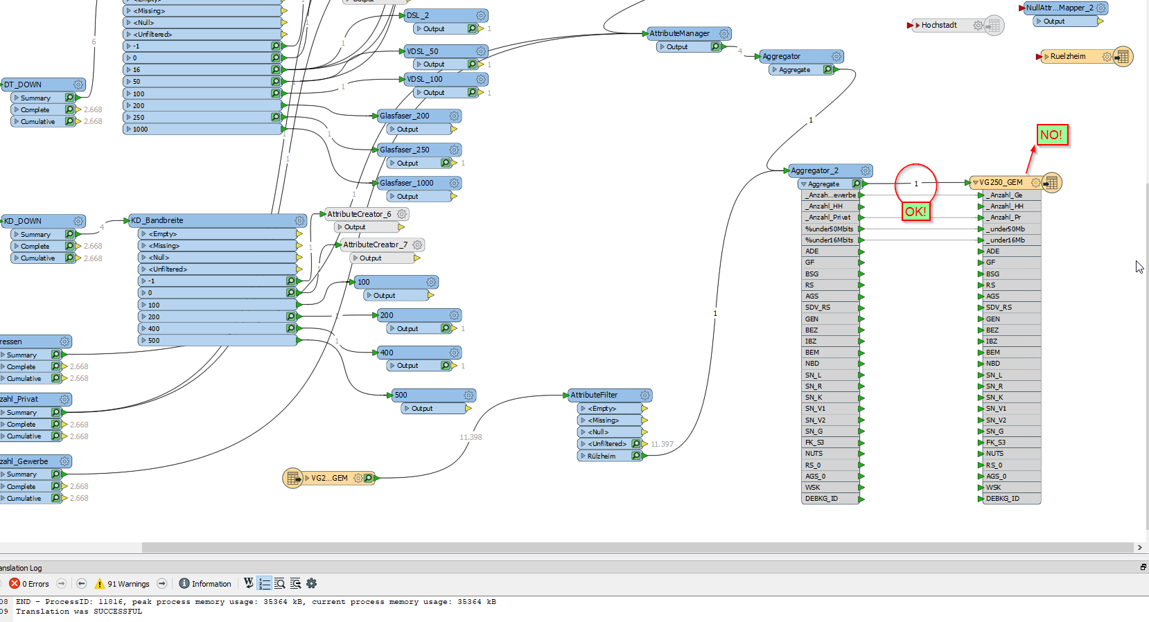
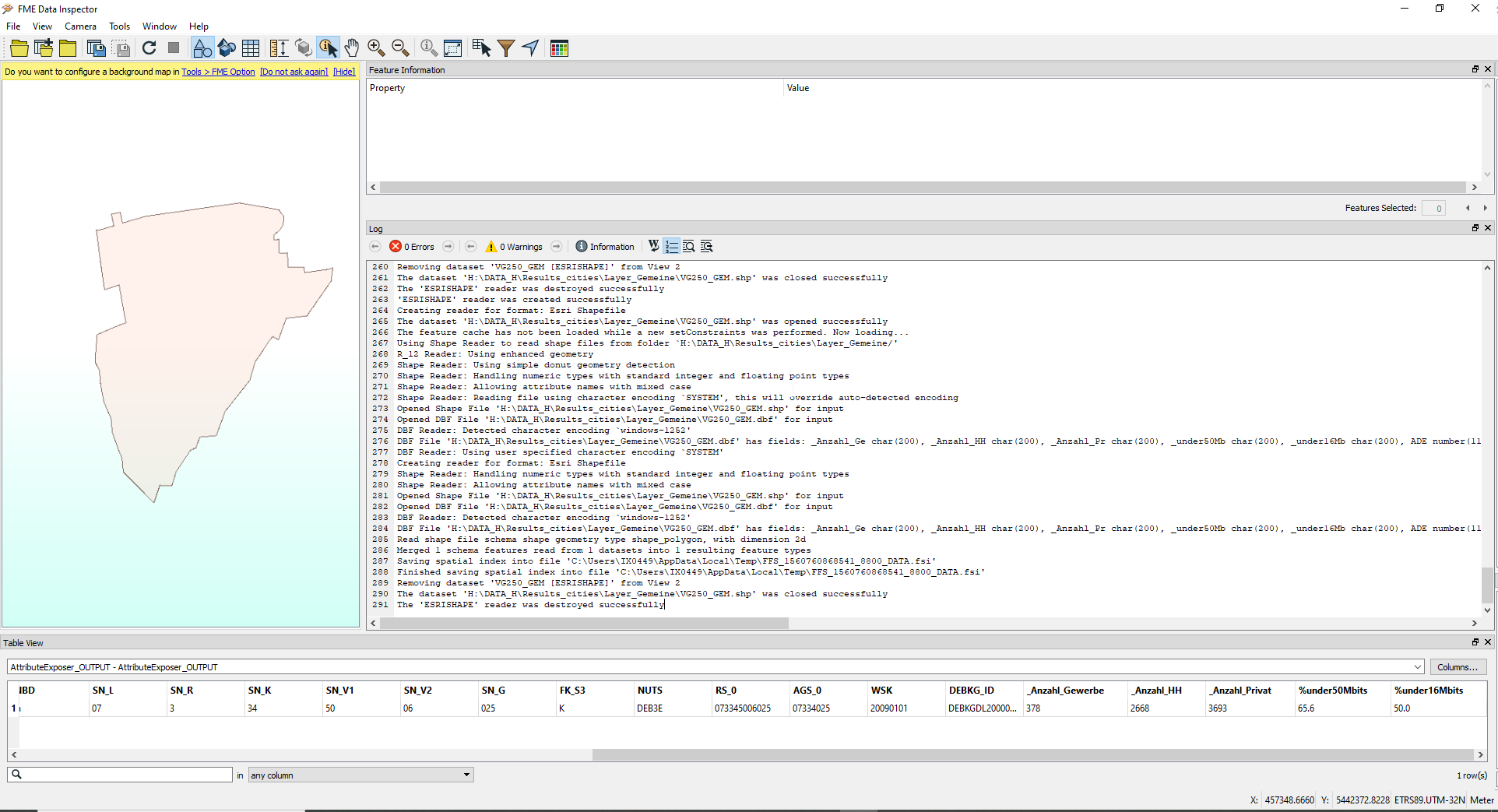
But when I inspect the writer, the result is empty... I checked the Shape in ArcGIS Pro, and there is also nothing. Any ideas why?

Thanks


11 replies

Badge +1

Hi @tereziastredna. In your writer properties, can you check if the geometry is correct from the drop down.

Badge

Hi @tereziastredna. In your writer properties, can you check if the geometry is correct from the drop down.

hi,

I am not sure, what should I check?

Badge +22

What does your logfile say?


Is there any mention of the writer rejecting a feature?
Badge

What does your logfile say?


Is there any mention of the writer rejecting a feature?

Hi,

see screenshot, please.


Badge +22

Hi,

see screenshot, please.


Sorry, I meant the logfile of the workspace that is supposed to produce the shapefile, not the inspector.

Badge

Sorry, I meant the logfile of the workspace that is supposed to produce the shapefile, not the inspector.

Hi,


I am very sorry. I have no so many experiences with FME...

there seems to be everything OK

Badge +22

Hi,


I am very sorry. I have no so many experiences with FME...

there seems to be everything OK

That is the right log file, however the information we need would be further back. Would it be possible to upload the logfile itself, rather than a screen capture?


You have 57 warnings, one or more of them probably explains the lack of features.
Badge

That is the right log file, however the information we need would be further back. Would it be possible to upload the logfile itself, rather than a screen capture?


You have 57 warnings, one or more of them probably explains the lack of features.

HI,


here the log file

Edited_Verfuegbarkeit_Liste_Landgrab.zip

Badge +22

HI,


here the log file

Edited_Verfuegbarkeit_Liste_Landgrab.zip

2019-06-17 17:16:38| 3.9| 0.0|WARN |Dropping heterogeneous aggregate feature for the ESRISHAPE Writer, due to feature type allowed geometries restriction


This indicates that you have an aggregate containing different types of geometries (example points and polygons) which the shape format does not allow.
Badge +10

2019-06-17 17:16:38| 3.9| 0.0|WARN |Dropping heterogeneous aggregate feature for the ESRISHAPE Writer, due to feature type allowed geometries restriction


This indicates that you have an aggregate containing different types of geometries (example points and polygons) which the shape format does not allow.

To solve this, you can use a GeometryFilter just before the Aggregator. Set it to filter Areas. It should remove all features that are not areas.

Badge +6

Its good to remember that the Log file only notes errors that it received during the translation, it would be helpful if shared a sample of your data. This can be done by connecting Sampler transformer followed by a FME Feature Store (FFS) Writer immediately before your shapefile writer. Then just attach the .ffs file to your post here.

Info on the Feature Store Writer: https://docs.safe.com/fme/html/FME_Desktop_Documentation/FME_ReadersWriters/ffs/ffs.htm

I've had issues where the translation reported no errors but the ArcGIS file written was no good, in my case it was writing a table that had fields matching ArcGIS reserved field names. In that case the FME log file showed that everything was fine, however even though the file was written some of the fields simply contained no data.

Its unlikely that this is your issue but there might be something similar going on where Esri has a architecture requirement test that your data is failing to pass.

Some tips on checking your field names:

List of ArcGIS reserved words: https://support.esri.com/en/technical-article/000010906

List of ArcGIS reserved characters: https://support.esri.com/en/technical-article/000005588

Here is a workbench I created with transformers pre-configured to check field names and report out any issues found, its useful to copy & paste it at the end of your process to do a quick name check: AttributeNameChecker_ESRI_FGDB.fmwt

Best of luck

Reply