

Hello,
I have polygon from postGIS DB and raster file. I want to use clipper to get part of raster file that is inside polygon which is used as clipper.
Here is the clipper:
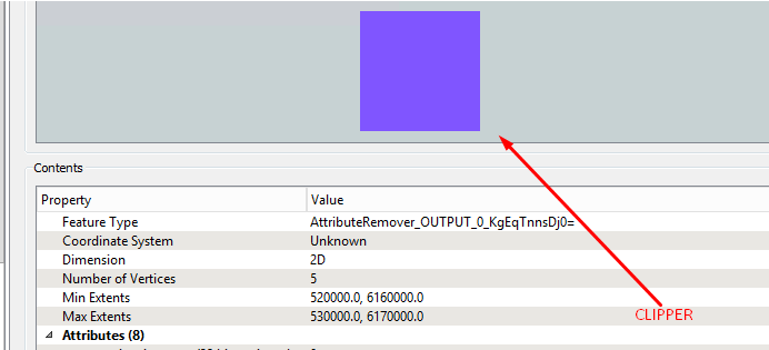
It should be a 10x10 km box.
Please take a look at min extents: 520000.0 , 6160000.0
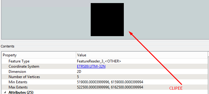
And here is the clippee (raster file)
And now I'm very surprised with clipper output (inside):
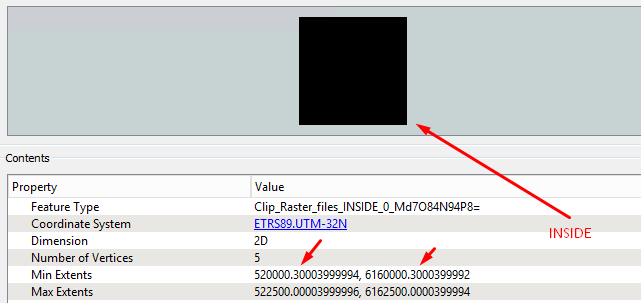
I don't know why that .3 appeared at decimal place?
Do you know what am I doing wrong?
My expectation is that it should start with border of clipper which is exactly 6160000.0


