I cannot connect to an ArcGIS Server Feature Service though either a reader connection or a feature reader.
The service I am trying to connect to is:
https://services.thelist.tas.gov.au/arcgis/rest/services
I have not problems connecting and accessing the data through ArcPro
I am using FME 2019.1.0.0 (20190710 - Build 19608 - WIN 64) with and Oracle Floating Licence
And also have FME 2015 installed, which i need to keep until we have updated some legacy processes.
There is probably something very simply I am missing but for the life of can't see it.
Below is the translation log from when I try to connect to the service with an ESRI ArcGIS Server Feature Service Reader ( I have highlighted the errors in Bold):
Starting translation...
FME 2019.1.0.0 (20190710 - Build 19608 - WIN64)
FME Desktop Oracle Edition (floating)
Permanent License.
Machine host name is: TN4405
Operating System: Microsoft Windows 10 64-bit (Build 18362)
Copyright (c) 1994 - 2019, Safe Software Inc.
Safe Software Inc.
2020-03-25 10:30:19| 0.3| 0.3|INFORM|Creating reader for format: Esri ArcGIS Server Feature Service
2020-03-25 10:30:19| 0.3| 0.0|INFORM|Trying to find a PYTHON plugin for reader named `ARCGISFEATURES'
2020-03-25 10:30:19| 0.3| 0.0|INFORM|The workspace does not contain user Python. FME will attempt to use a Python 3.7+ interpreter
2020-03-25 10:30:19| 0.3| 0.0|INFORM|Using Python interpreter from `C:\\Program Files\\FME 2019\\fmepython37\\python37.dll' with PYTHONHOME `C:\\Program Files\\FME 2019\\fmepython37'
2020-03-25 10:30:19| 0.3| 0.0|INFORM|Python version 3.7 loaded successfully
2020-03-25 10:30:22| 1.6| 1.3|INFORM|Loaded Python module `arcgisonlinefeatures' from file `C:\\Program Files\\FME 2019\\python\\python37\\arcgisonlinefeatures\\__init__.pyc'
2020-03-25 10:30:22| 2.2| 0.5|INFORM|ArcGIS Feature Service Reader: Using authentication type 'None'
2020-03-25 10:30:22| 2.2| 0.0|INFORM|ArcGIS Feature Service Reader: Requesting metadata for Feature Service at 'https://services.thelist.tas.gov.au/arcgis/rest/services'
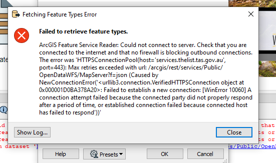
2020-03-25 10:31:04| 2.4| 0.2|ERROR |ArcGIS Feature Service Reader: Could not connect to server. Check that you are connected to the internet and that no firewall is blocking outbound connections. The error was 'HTTPSConnectionPool(host='services.thelist.tas.gov.au', port=443): Max retries exceeded with url: /arcgis/rest/services?f=json (Caused by NewConnectionError('<urllib3.connection.VerifiedHTTPSConnection object at 0x00000000093D90B8>: Failed to establish a new connection: [WinError 10060] A connection attempt failed because the connected party did not properly respond after a period of time, or established connection failed because connected host has failed to respond'))'
2020-03-25 10:31:04| 2.4| 0.0|WARN |A fatal error has occurred. Check the logfile above for details
2020-03-25 10:31:04| 2.4| 0.0|ERROR |Failed to obtain any schemas from reader 'ARCGISFEATURES' from 1 datasets. This may be due to invalid datasets or format accessibility issues due to licensing, dependencies, or module loading. See logfile for more information
2020-03-25 10:31:04| 2.4| 0.0|INFORM|FME Session Duration: 46.6 seconds. (CPU: 0.9s user, 1.4s system)
2020-03-25 10:31:04| 2.4| 0.0|INFORM|END - ProcessID: 14608, peak process memory usage: 59292 kB, current process memory usage: 59252 kB
Failed to obtain any schemas from reader 'ARCGISFEATURES' from 1 datasets. This may be due to invalid datasets or format accessibility issues due to licensing, dependencies, or module loading. See logfile for more information
Program Terminating
Translation FAILED.
Warning: not all FMESessions that were created were destroyed before shutdown. This may cause instability
Workspace generation failed. Parameter file was C:\\Users\\DoyleJa\\AppData\\Local\\Temp\\FME_1585092615591_18160.