I’m currently working on a project where we have 3D mesh models (SLPK or 3DML) and I’m looking to convert these into point clouds. My goal is to use ArcGIS Pro with the Imagery Analyst Extension to extract and classify all tree points.
We’ve had great success using the Tree Classification deep learning model with LiDAR data, and I’m curious if this approach could help us save costs by not needing to collect new LiDAR data when we already have 3D mesh models from the same year to convert 3D mesh to point cloud.
Has anyone here had experience with this type of conversion? Any insights on the process, potential challenges, or tips would be greatly appreciated!
Thank you in advance for your help!
Best regards,
Reno
Page 1 / 1
Hi, @renosungis.
Thanks for posting your question! At this time, we don’t have a Reader for SLPK or 3DML (Ideas page for 3DML). We wanted to ask if you could export the model into a format we support? Otherwise, we think the process would generally be Reader -> PointCloudCombiner -> Writer. Believe the vector tolerance parameter will allow for control point density.
Thanks for replying the post and providing 3D Model to Point Cloud info.
The 3DML format is likely different than the Rhino 3DM file format.
I noticed the 3D Mesh (3DML) is supported by a software called TerraExplorer Skyline.
I tried ArcGIS Pro Extract LAS geoprocessing tool to extract point cloud from the 3D Mesh (SLPK) as well…but no luck.
I am also asking the vendor who provide both SLPK and 3DML of city’s 3D Mesh model to see if they are able to provide the model in point cloud format or not.
Thanks for your help!
Hey, @renosungis.
No problem! Good catch, sorry about that! Sounds good, if you have any more questions around the resources we have, don’t hesitate to ask, happy to help!
Thanks!
Hi @AliAtSafe,
I discovered that Skyline’s TerraExplorer can convert 3DML/SLPK files to .las/.laz formats.
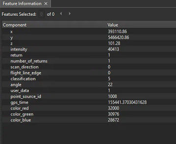
I converted a 3D Mesh (City/Town) model to a 0.1m point cloud (.las) using TerraExplorer and encountered an error while using the Tree Point Classification model to extract tree points. The error message was as follows: ERROR 050163: The input data does not have the following attributes required by the classification model: numberOfReturns. Failed to execute (ClassifyPointCloudUsingTrainedModel).
All 3D Mesh converted point clouds have the number of returns set to 1 by examining 3D Mesh converted point cloud using FME Inspector. However, the classification model still saying those 3D mesh point cloud missing numberOfReturns attribute.
Any assistance would be greatly appreciated! Alternatively, if there could be a new Tree Point Classification model that doesn’t require the number of returns but utilizes RGB with X, Y, Z for 3D Mesh converted point clouds, that would be fantastic!
Maybe 3D Mesh Point Cloud just won't work with this classification model, but it brings a great potential/idea to add one more benefits of having a 3D mesh model if it can help extracting tree coverages, buildings and other municipal assets.
Any help and suggestions are appreciated!
Hi, @renosungis.
Thank you for your patience, appreciate it. Great to hear! If the error was encountered in Skyline’s TerraExplorer, it would be best to reach out to them for support. We are more than happy to assist you with FME related issues. Let us know, we will be more than happy to assist with your use case.