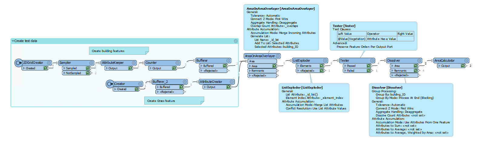
I have been working with the following workflow:
- Bufferer to buffer the buildings with 50 meter
- Clipper to clip the vegetation to the buffers
- Spatial filter where "BuildingBuffers OGC-Contains Vegetation". The vegetation is the candidate.
- Area calculator of the resulting areas
- Statistic Calculator to sum the calculated vegetation area for each building ID.
The result is missing data for many of the building buffers. I think one problem is that the vegetetad areas only are counted once, while in reality they can be included in many of the building buffers. Do you have any advice?


")

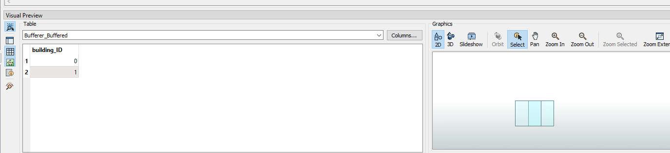 As you can see they overlap. I have also created a vegetation feature:
 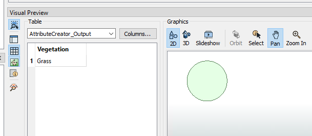 I put them in the AoAO with these settings:
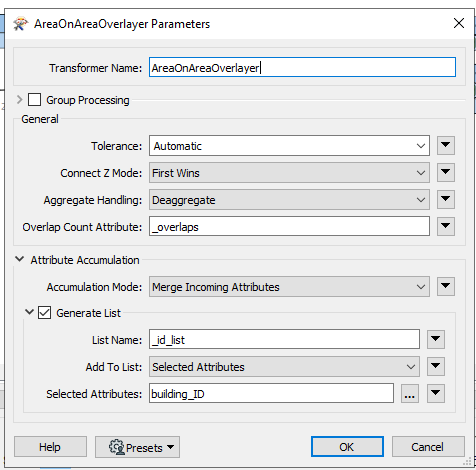 This is the result, note that the ID list I have created is not yet visible in the Visual Preview window:
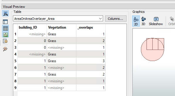 I then put this through the ListExploder (where List Attribute = _id_list{}), which gives me this:
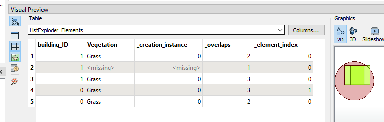 The red part is output through the <Rejected port>. This feature has no overlap with a building, and thus no _id_list{} attribute.
 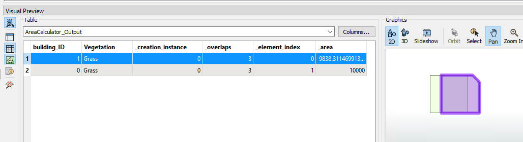 Maybe I should have made another vegetation feature, since nearly all our building features overlap entirely with the vegetation feature..