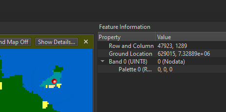
I am working with Copernicus WorldCover data and I wonder how FME is reading pixel values. I read the data with a FeatureReader, to intersec t the input with my AOI, and looking at the cached results of the FeatureReader I get 'NoData' in the Data Inspector, when selecting an area where the color map is interpreted correctly and according to the product description from ESA the color indicates a map code of 90.
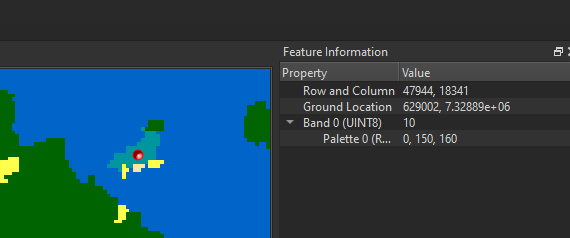
 The subsequent applied RasterMosaicker shows the following result, at the same location.
 Now the value changed from '0 NoData' to '10'.
As described, the color indicates a value of 90!
The problem is basically present in any of the mapped classes, and values are altered from
10 -> 2
20 -> 3
30 -> 4
etc.
90 -> 10
I am adding a link to the coding of the map layer and definition of the classes and two Copernicus images so you can try to read a single GeoTIFF and reading all GeoTIFF files in a folder -> https://drive.google.com/drive/folders/1jusyArd5ugYSJtk3auGcu60Ogd_gTWlE?usp=sharing
When the FeatureReader is set to read a single GeoTIFF, the values are correct interpreted, but setting the source for the FeatureReader to C:\\Projects\\*.tif leads to '0 (NoData)' when reading GeoTIFF and subsequently the values are wrong in the workflow.
Am I doing something wrong or is the imagery misinterpreted?
I am working with FME Desktop Data Interoperability FME(R) 2022.0.0.2 (20220518 - Build 22343 - WIN64) and FeatureReader is in version 13.


 Let me know if you have any issues with this!