Question

Group Polylines Spatially

  • January 10, 2020
  • 2 replies
  • 9 views

parashari
Forum|alt.badge.img+2

Hi,

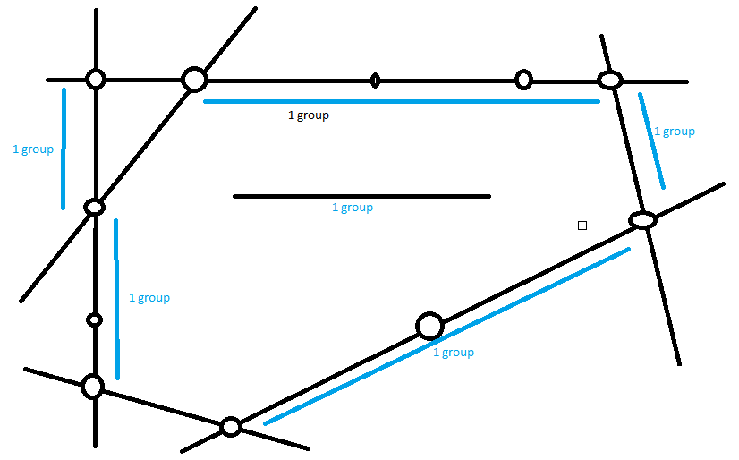
I have a road network that I want to group on spatial basis. I want to group the roads on 3 valent or more junction on the basis of connectivity.

I have tried using TopologyBuilder and ListElementCounter to calculate the node valency, but not getting how to group them.

I have uploaded the data in the attachment.


Thanks.

This post is closed to further activity.
It may be an old question, an answered question, an implemented idea, or a notification-only post.
Please check post dates before relying on any information in a question or answer.
For follow-up or related questions, please post a new question or idea.
If there is a genuine update to be made, please contact us and request that the post is reopened.

2 replies

cdalessandro
Contributor
Forum|alt.badge.img+4
  • Contributor
  • 19 replies
  • January 10, 2020

Hi,

I guess I lack some details. Anyway, From what I'm seeing , Maybe You just need to use LineCombiner transformer.


bwn
Evangelist
Forum|alt.badge.img+26
  • Evangelist
  • 562 replies
  • January 10, 2020

To look at this another way, it appears what is needed is instead to find lines that touch at their end points and there are no more than 2 lines touching each other at their end points, and to group them together.

This is the default behaviour of LineCombiner. This will create a List of line segments that touch each other at their end "Junction" points and the valency is no more than 2 line end points touching that Junction.

Sending the LIneCombiner output to a Counter will then put a "Group ID" integer against the groups of combined lines.