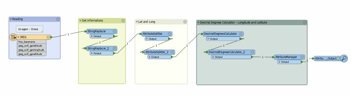
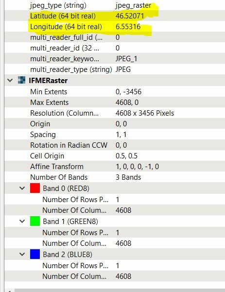
I have a drone image ( jpeg ) and there are some metadatas informations, for example: longitude and latitude.
I extracted these informations - center point of image.
My goal is try to georrefencing this file using the transformer RasterGeoreferencer:
Thanks,
Danilo
Best answer by danilo_fme
You'll need to know a bit more than just the center. Pixel size is very important too, as well as whether or not there is a rotation involved. Without these you're not going to be able to georeference it properly using the RasterGeoreferencer.
Thanks @redgeographics :)
This post is closed to further activity.
It may be an old question, an answered question, an implemented idea, or a notification-only post.
Please check post dates before relying on any information in a question or answer.
For follow-up or related questions, please post a new question or idea.
If there is a genuine update to be made, please contact us and request that the post is reopened.
You'll need to know a bit more than just the center. Pixel size is very important too, as well as whether or not there is a rotation involved. Without these you're not going to be able to georeference it properly using the RasterGeoreferencer.
You'll need to know a bit more than just the center. Pixel size is very important too, as well as whether or not there is a rotation involved. Without these you're not going to be able to georeference it properly using the RasterGeoreferencer.
You'll need to know a bit more than just the center. Pixel size is very important too, as well as whether or not there is a rotation involved. Without these you're not going to be able to georeference it properly using the RasterGeoreferencer.
How to use the reprojections of the omega phi kappa value?