Question

Can I trace downstream after creating sinks using end points of my lines?

  • July 1, 2015
  • 4 replies
  • 172 views

geospatiallover
Participant
Forum|alt.badge.img+6
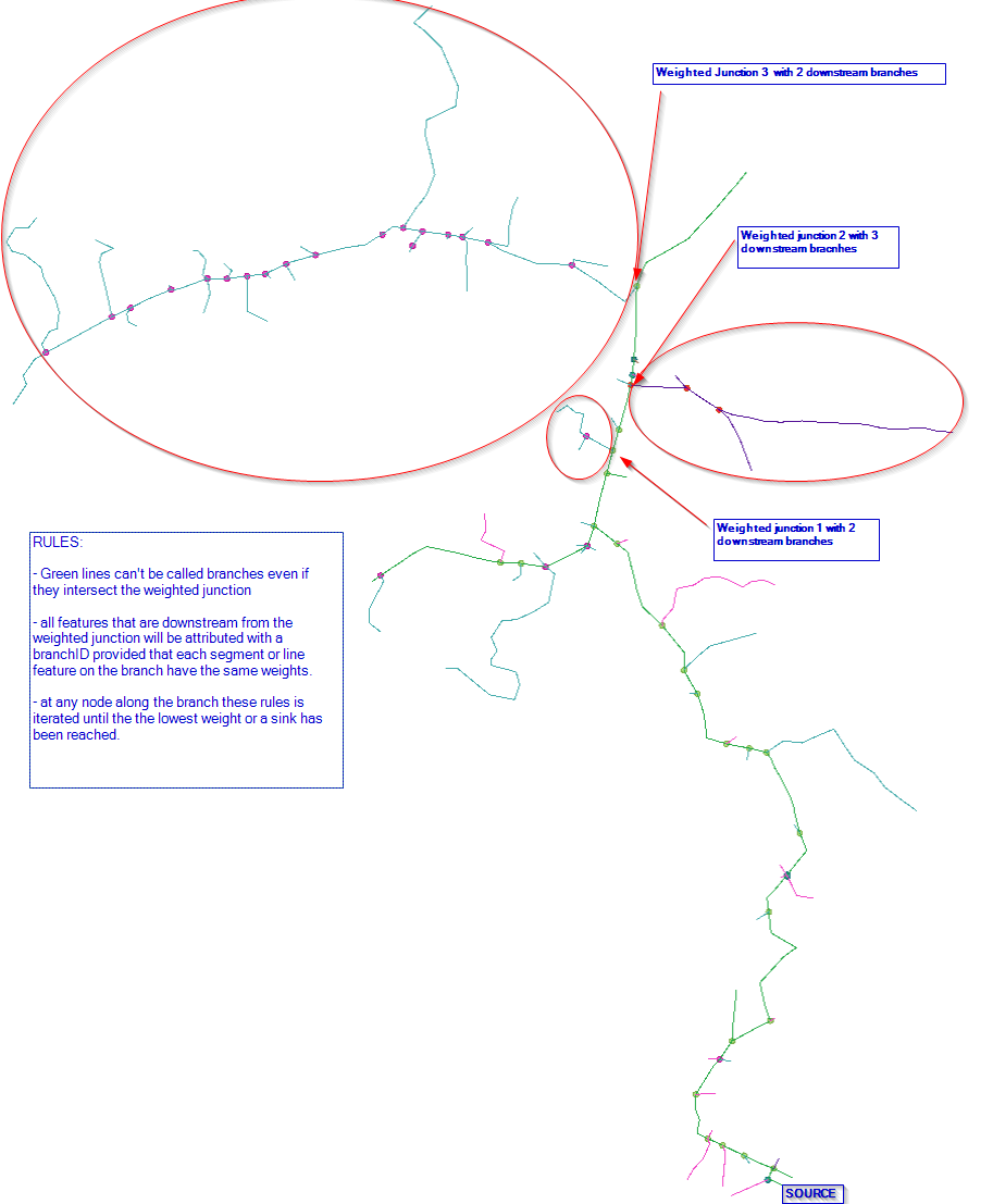
I want to pick up junctions with a certain weight along my network and determine how many more nodes and line features that are on each branch coming out of each selected junction.
This post is closed to further activity.
It may be an old question, an answered question, an implemented idea, or a notification-only post.
Please check post dates before relying on any information in a question or answer.
For follow-up or related questions, please post a new question or idea.
If there is a genuine update to be made, please contact us and request that the post is reopened.

4 replies

geospatiallover
Participant
Forum|alt.badge.img+6
Some additional info on my question.


gio
Contributor
Forum|alt.badge.img+15
  • Contributor
  • July 3, 2015
Creating network for the relations streams/junctions is basic.


But afaiuu want  a recursive procedure?

geospatiallover
Participant
Forum|alt.badge.img+6
Yes, it is intended to be a recusive procedure. I'm prepping the points and branches for labelling and symbolizing later for automated map making. I want to reduce the collisions on each junction and or its branch by either moving, scaling, or extending segments and/or points or even branches.I'm facing a wall with the downstream as I have tried multiple options (Linear referencing and netowrk topology) and it always leads me to a preliminary step of creating a segmentation sequence either using distance from the source or using spatial sequence as the "eye" sees the whole data. The iteration will apply rules until it has reached maximum allowable collisions and then lock the junction node or branch and points inside the zone to move to the next downstream junction and its branch until all branches and their endpoints have been reached. So by testing on each junction a lock may be imposed on a compleeted junction and its adjacent branches so there a will be base for the collision zones to refer to.

geospatiallover
Participant
Forum|alt.badge.img+6

Problem solved by @takashi in this blogpost Solution