

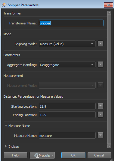
I have turned my roadnetwork in a LRS (linear referenced road network) with measures. Now I have a table with roadaccidents without coordinates, but with the measures corresponding to the LRS (e.g. km 12.90). Is it possible to locate these locations on the map, using the LRS, and thus find the coordinates? The best solution I've found so far is to extract the nearest measure values, but these dont get close enough.

Question
Can FME locate 'events' that only have a measure, but no coordinates, on a LRS
This post is closed to further activity.
It may be an old question, an answered question, an implemented idea, or a notification-only post.
Please check post dates before relying on any information in a question or answer.
For follow-up or related questions, please post a new question or idea.
If there is a genuine update to be made, please contact us and request that the post is reopened.


Login to the community
No account yet? Create an account
An FME Account is required to contribute
LoginEnter your E-mail address. We'll send you an e-mail with instructions to reset your password.