Dear FME community,
I have a question regarding a road network:
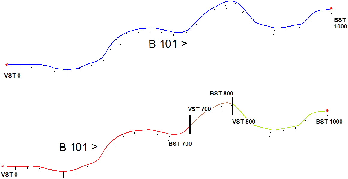
I have a single road (top blue line) which is called "B 101". The road system has something like a positioning. Each road segment is divided into meters called "the stations", which are similar to a kilometrage on a highway, but the calculation of the stations restarts at every network point (the small red circles). They begin with the start position of 0 (attribute VST -> "FROM station"), and have different end positions (attribute BST -> "TO station") according to the length of the road. In the example the road goes from 0-1000, and therefore it is 1000m long in total. The station number increases with each full meter, the count direction is indicated by the ">" sign.
In my workspace, I'm splitting these roads into smaller road segments. The blue road is split for example into the red road part, the brown and the green road part. The red part is not needed any more, but the brown + green parts becomes the new roads. I want to calculate the new positioning, which goes from 700 to 800 (brown road) and from 800 to 1000 (green road). The old information (0-1000) which the two lines still have, should be overwritten.
Is there a way how this can be achieved with FME? It could be that the road is split at meter 800,25..., then I guess I have to round it to the next integer.
Many thanks for every help and kind regards
Thomas


