Hi All,
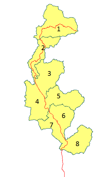
Hopefully this is a quick question. Basically I have a bunch of 8 polygons, with no attributes. Basically I want to add a ID to each of these, but taking into account their location to each other. I.e. ID 1 should be next to ID 2 etc, similar to the image I mocked up below.
The Counter just randomly assigns an ID, but not in order. Similar with the GOIDGenerator.
The only other thing I have that links the polygons is a line feature, also seen in the image, which either Crosses or Touches each polygon. This line is orientated running from North to South, however in other instances this could be any orientation, so I can't try and extract centre points etc from polygons.

I'm almost certain I don'e something like this before, but can't remember how, and it has me stumped!
Cheers,
Tony


