

Hello everyone!
I struggle with understanding how ArcByCentrepoint (and Circle) are implemented in AIXM 5.1/GML. I ingest exactly the same dataset in FME and QGIS. However, in FME everything looks correct whereas QGIS butchers the geometry.
I tried this with class C airspaces around Munich and other airspaces. The system behavior is the same regardless of the airspace. These discrepancies are not just ugly, but they also lead to partially invalid geometries. I have attached example screenshots.
In FME
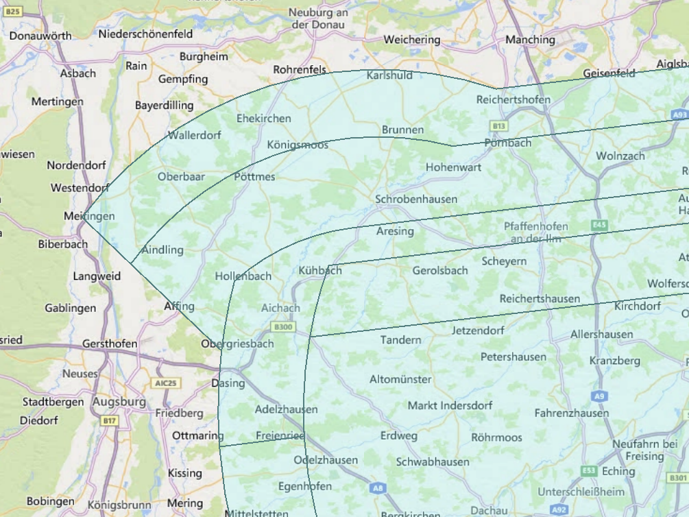 In QGIS
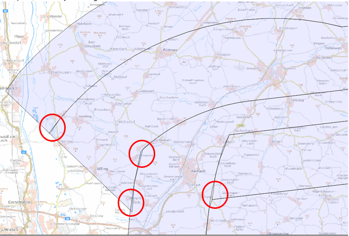 I believe that these discrepancies may occur due to each application utilizing a slightly different projection, e.g. UTM, AZMED, AZMEA, and other local coordinate reference systems are probably just part of a longer list. With each projection, the displayed geometries are slightly differently skewed in terms of distances and angles.
So far, I have selected Lambert Azimuthal Equidistant Projection for my calculations/constructions, which originate at the circle’s midpoint. In my understanding, it is possible to measure the radius and angles very precisely once projected. I use the "CommonLocalReprojector" to accomplish this task.
Whether that is the ideal approach to projection is debatable. However, it would be important to standardize the projection used for calculating angles and distances. Ideally, this would not be in UTM since problems with the different UTM zones occur rather quickly.
Since everything works well using FME, I would like to know which projection is used in FME to interpret these geometries and preferably learn the reason for the incorrect display in QGIS?
To standardize the processes in our organization, it would be helpful if somebody could outline the steps that lead from a GML-geometry to a stroked arc in the inspector - not in FME-Transformers but technically.
Thank you for your help,
Jan-Philipp


 In AIXM the center point is usually in lat lon (but not always!). FME will try to interpret the unit of measurement of the radius lengths and circles. FME arcs and circles radius are assumed to be in the same ground units as the coordinate system. In this case, AIXM5 data is in EPSG:4326 (unless you're using a different one) where the ground units are lat lon, and therefore you have to calculate the length of one degree.