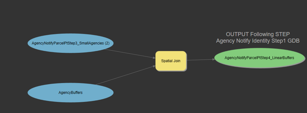
 AddressID "AddressID" true true false 4 Long 0 0,First,#,AgencyNotifyParcelPtStep2_LargeAgencies,AddressID,-1,-1;APN "APN" true true false 9 Text 0 0,First,#,AgencyNotifyParcelPtStep2_LargeAgencies,APN,0,9;SubType "SubType" true true false 4 Long 0 0,First,#,AgencyNotifyParcelPtStep2_LargeAgencies,SubType,-1,-1;AddressType "AddressType" true true false 13 Text 0 0,First,#,AgencyNotifyParcelPtStep2_LargeAgencies,AddressType,0,13;FullAddress "FullAddress" true true false 62 Text 0 0,First,#,AgencyNotifyParcelPtStep2_LargeAgencies,FullAddress,0,62;StreetNumber "StreetNumber" true true false 4 Long 0 0,First,#,AgencyNotifyParcelPtStep2_LargeAgencies,StreetNumber,-1,-1;StreetNameFull "StreetNameFull" true true false 50 Text 0 0,First,#,AgencyNotifyParcelPtStep2_LargeAgencies,StreetNameFull,0,50;PrefixDir "PrefixDir" true true false 2 Text 0 0,First,#,AgencyNotifyParcelPtStep2_LargeAgencies,PrefixDir,0,2;StreetName "StreetName" true true false 36 Text 0 0,First,#,AgencyNotifyParcelPtStep2_LargeAgencies,StreetName,0,36;StreetType "StreetType" true true false 4 Text 0 0,First,#,AgencyNotifyParcelPtStep2_LargeAgencies,StreetType,0,4;SuffixDir "SuffixDir" true true false 4 Text 0 0,First,#,AgencyNotifyParcelPtStep2_LargeAgencies,SuffixDir,0,4;UnitType "UnitType" true true false 4 Text 0 0,First,#,AgencyNotifyParcelPtStep2_LargeAgencies,UnitType,0,4;Unit "Unit" true true false 6 Text 0 0,First,#,AgencyNotifyParcelPtStep2_LargeAgencies,Unit,0,6;AlternateAddress "AlternateAddress" true true false 62 Text 0 0,First,#,AgencyNotifyParcelPtStep2_LargeAgencies,AlternateAddress,0,62;CitySitus "CitySitus" true true false 22 Text 0 0,First,#,AgencyNotifyParcelPtStep2_LargeAgencies,CitySitus,0,22;CityMailing "CityMailing" true true false 22 Text 0 0,First,#,AgencyNotifyParcelPtStep2_LargeAgencies,CityMailing,0,22;State "State" true true false 2 Text 0 0,First,#,AgencyNotifyParcelPtStep2_LargeAgencies,State,0,2;ZipCode "ZipCode" true true false 10 Text 0 0,First,#,AgencyNotifyParcelPtStep2_LargeAgencies,ZipCode,0,10;Floor "Floor" true true false 2 Short 0 0,First,#,AgencyNotifyParcelPtStep2_LargeAgencies,Floor,-1,-1;IsPrimary "IsPrimary" true true false 1 Text 0 0,First,#,AgencyNotifyParcelPtStep2_LargeAgencies,IsPrimary,0,1;HasSecondaryUnits "HasSecondaryUnits" true true false 1 Text 0 0,First,#,AgencyNotifyParcelPtStep2_LargeAgencies,HasSecondaryUnits,0,1;AddressIDPrimary "AddressIDPrimary" true true false 4 Long 0 0,First,#,AgencyNotifyParcelPtStep2_LargeAgencies,AddressIDPrimary,-1,-1;Status "Status" true true false 10 Text 0 0,First,#,AgencyNotifyParcelPtStep2_LargeAgencies,Status,0,10;ADU "ADU" true true false 4 Long 0 0,First,#,AgencyNotifyParcelPtStep2_LargeAgencies,ADU,-1,-1;District "District" true true false 32 Text 0 0,First,#,AgencyNotifyParcelPtStep2_LargeAgencies,District,0,32;LargeMiscellaneous "Large Miscellaneous" true true false 254 Text 0 0,First,#,AgencyNotifyParcelPtStep2_LargeAgencies,LargeMiscellaneous,0,254;SmallMiscellaneous "SmallM iscellaneous" true true false 254 Text 0 0,First,#,SmallAgencyAreas,SmallMiscellaneous,0,254
Not sure if this needs some Python conversion first?


