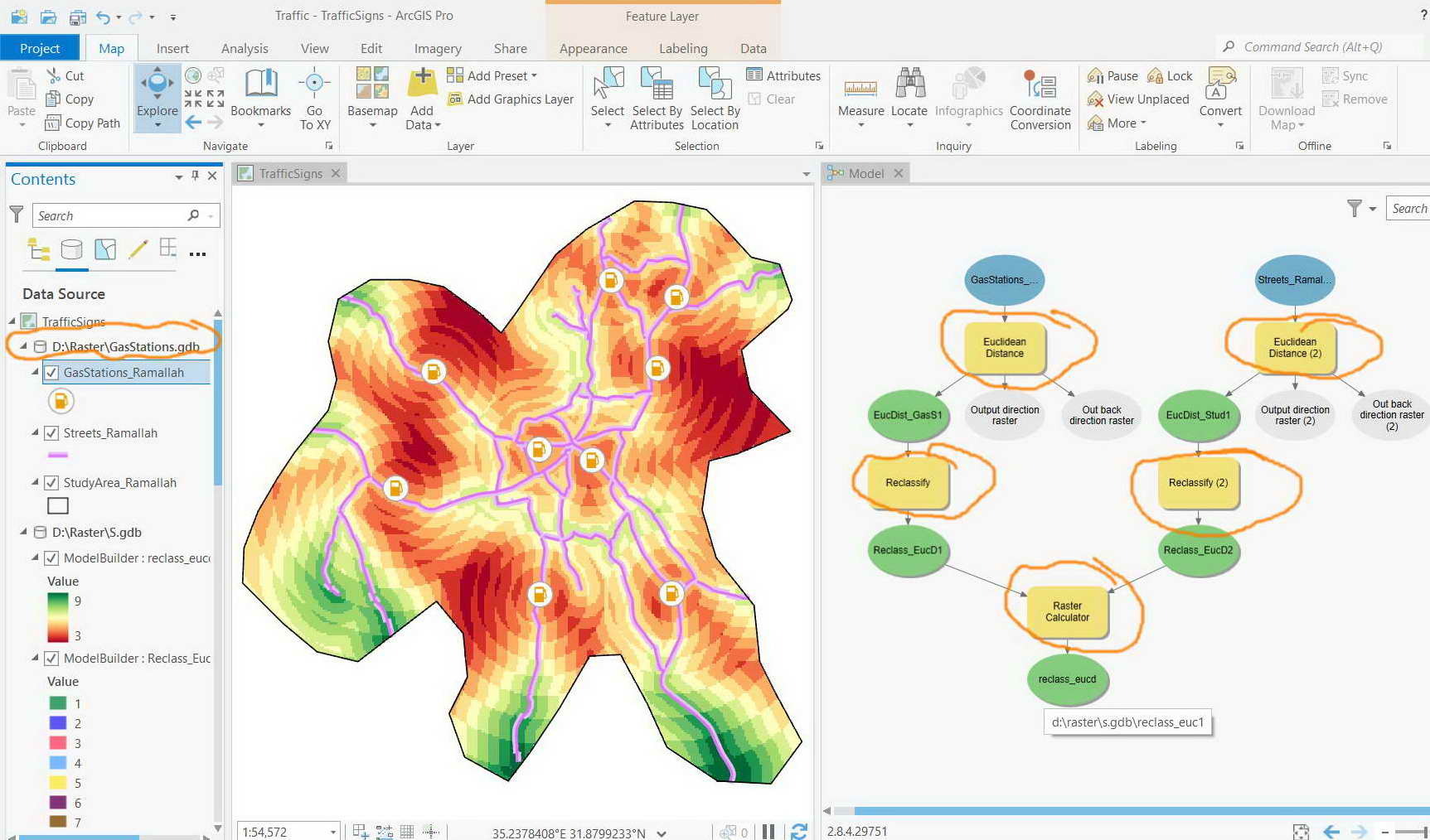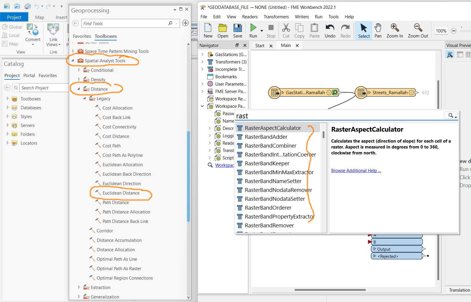

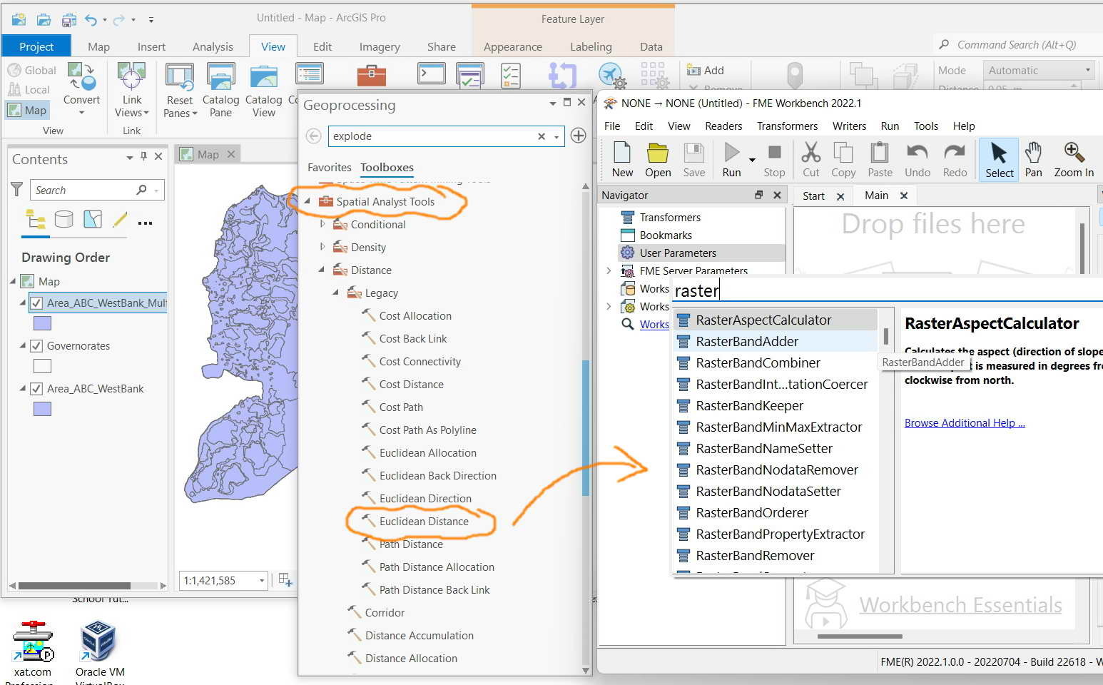
FME Desktop 2022.1: What is the equivalent tool of “Euclidean distance” of ArcGIS Pro in FME?
I couldn’t figure of if all Raster tools that are available in ArcGIS Pro have equivalent tools\\transformers in FME
For example, what is the equivalent tool of “Euclidean distance” of ArcGIS Pro in FME?


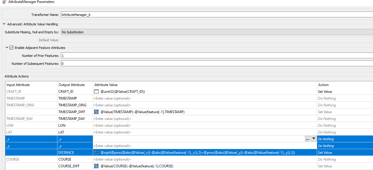 @sqrt(@pow(@abs(@Value(_x))-@abs(@Value(feature[-1]._x)),2)+@pow(@abs(@Value(_y))-@abs(@Value(feature[-1]._y)),2))