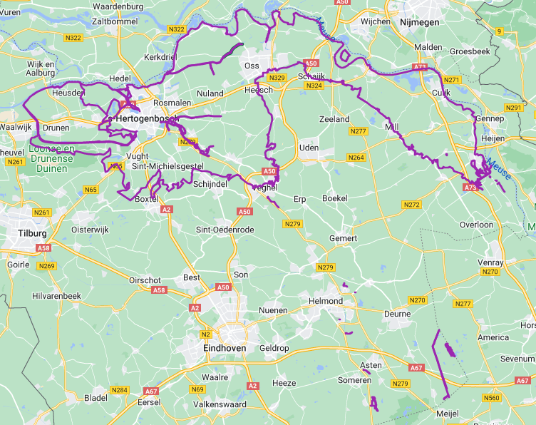


Hi, I'm struggling reading geometry from an xml file. When looking at a part of the (0.7Gb) large xml, I can see it has coordinates that reference a location I do not expect:
<gml:LineString srsName="urn:ogc:def:crs:EPSG::4258" gml:id="GEOMETRY_98ce8c1e-3676-4a60-b2a8-d7e63fe97d1d">
<gml:posList srsDimension="3">51.77106873325691 5.459700336196274 49.41166353587596 3.2520665388839736 47.937498062913775 8.934025947231504 51.771400476701494 5.460105669526139 49.412014702926356 3.25205099130662 47.937476504785614 8.934700858000644 51.77170841095756 5.460502642204418 49.412240574188026 3.252040990938717 47.93746470527796 8.935070205423436 51.771910436397455 5.46090045825306 49.41302764854071 3.2520061426583493 47.9374374566226 8.935922993715176 51.77277383456701 5.462819713112839
.
.
.
</gml:posList>
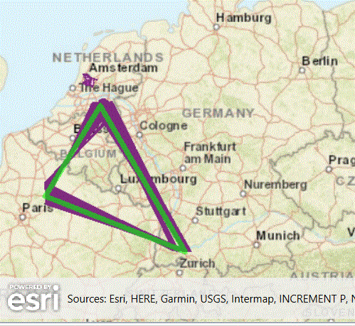
</gml:LineString>The 3D coordinates seem to alternate, which might have something to do with a side view from the data, I guess. When I look at the data in the viewer, it looks like:  Not all of the features in the xml file show this behavior. I tried a number of approaches to get rid of the outliers, yet none had satisfying results. I did a bit of Python scripting to remove each second coordinate, or remove out-of-range coordinates, experimented with XMLXQueryExtractor, used textfile reader or GML reader or XML reader, I'm a bit disappointed now. Anyone has any idea how to tackle this? Accompanying is an .fmwt file containing a simple workspace and data-extract to reproduce the problem. Any input would be greatly appreciated.
O, forgot to tell, using FME(R) 2022.0.1.0 (20220602 - Build 22346 - WIN64).


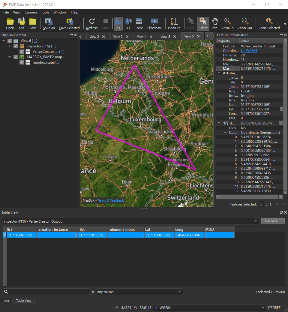 By splitting and joining the coordinates list I get the geometry in the image above.
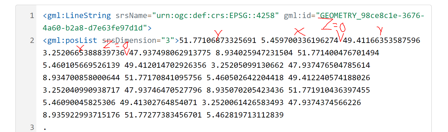


 I can share the python that will get you to this, but personally I wouldn't trust data that required this sort of manipulation