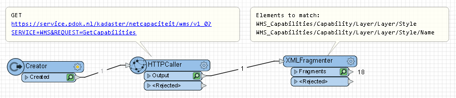


Hello, Im working with this WMS:
https://service.pdok.nl/kadaster/netcapaciteit/wms/v1_0?
When I access it with a feature reader then it gives me these layers here:
 And when ran it just gives me a white area cover of where the data is in the world (right place and all, just no symbols).
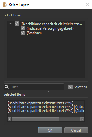
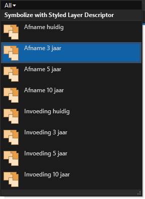
I am accessing the same data in ArcGIS Pro and there I can query "IndicatiefVerzorgingsgebied" based on symbology and see that it has some 8 sublayers:
So my questions are:
How can I query and expose these sublayers in FME and make them appear as something else than a white area coverage?
And bonuspoints if there are any ideas how to expose the feature specific attribute values as well, such as station, netbeheerder, status, totalecap... and so forth
Best answer by tono
View original