I have a WMTS that works fine in QGIS, but which I can not get to work in FME Desktop (2021.2 and 2022.1). I start the WMTS-reader, use the following address:
and than I get this error:
.tmp' exists but could not be opened. File contents may be invalid, or the file format may not be supported
Worker 1780 > Failed to obtain any schemas from reader 'WMTS' from 1 datasets. This may be due to invalid datasets or format accessibility issues due to licensing, dependencies, or module loading. See logfile for more information
Parameter settings are chosen from the layer itself:
format: Image/png
Tilematrix: Gooflemapscompatible
Tile resolution: 18
I did try other resolutions.
Again: It works fine in Qgis
Best answer by caracadrian
View original


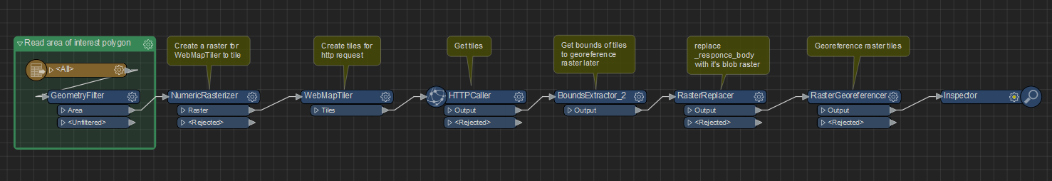 See also attached workspace.