


Hi,
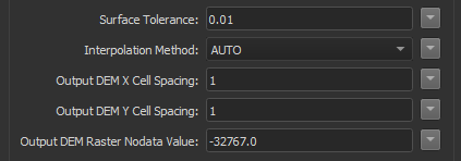
I am having problems with converting a TIN surface to a raster with height information. The input data is a LandXML which contains a surface of type IFMECompositeSurface. Right now I feed the surface into the RasterDEM generator with the following settings:
 The coordinate system is EPSG:28992 so the surface tolerance is set to 1cm, however the results are quite jagged:
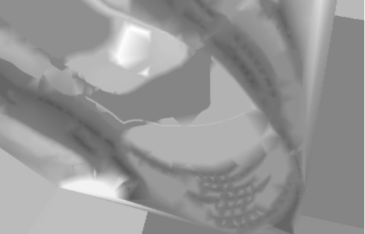 To give you a sense of scale, the image above is for an area of around 1300 meters wide so the the jagged points seen above are sometimes a 100 meters wide.
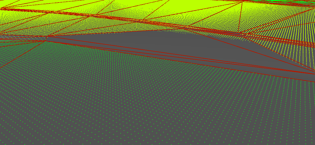
To check my results I decided to convert the result to a pointcloud so I could take a look and compare it with the original surface in the 3D view in FME Inspector. In the image below you can see that the pointcloud that was created from the raster actually dives beneath the original surface:
 Does anybody have an idea what could cause these problems?
I a doubting whether the RasterDEMGenerator is the right transformer for this job. I already have a workaround where I use the PointCloudCombiner and a NumericRasterizer for a much nicer and smoother result but that method has a problem dealing with very small faces which in the end cause holes to appear in the raster.
Best answer by daveatsafe
View original

