Solved

Neighbour Finder Query

  • 28 October 2021
  • 3 replies
  • 4 views

Badge +9

I have been using the neighbour finder to create a line between an existing point and road line, which works fine up to a point. I am sure the below is fairly straightforward but have been racking my brains to no avail. I have tried the group by which is giving some strange results too...


Both the Road and Point Datasets have a RoadID attribute meaning that all points should be linked to the correct road, this is not currently happening with some points being linked the shortest distance to the nearest road and not to the correct road.


image
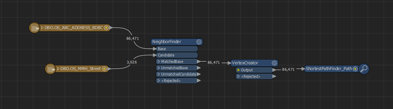
Any suggestions how i can get the points to link to the correct road via the RoadID field?


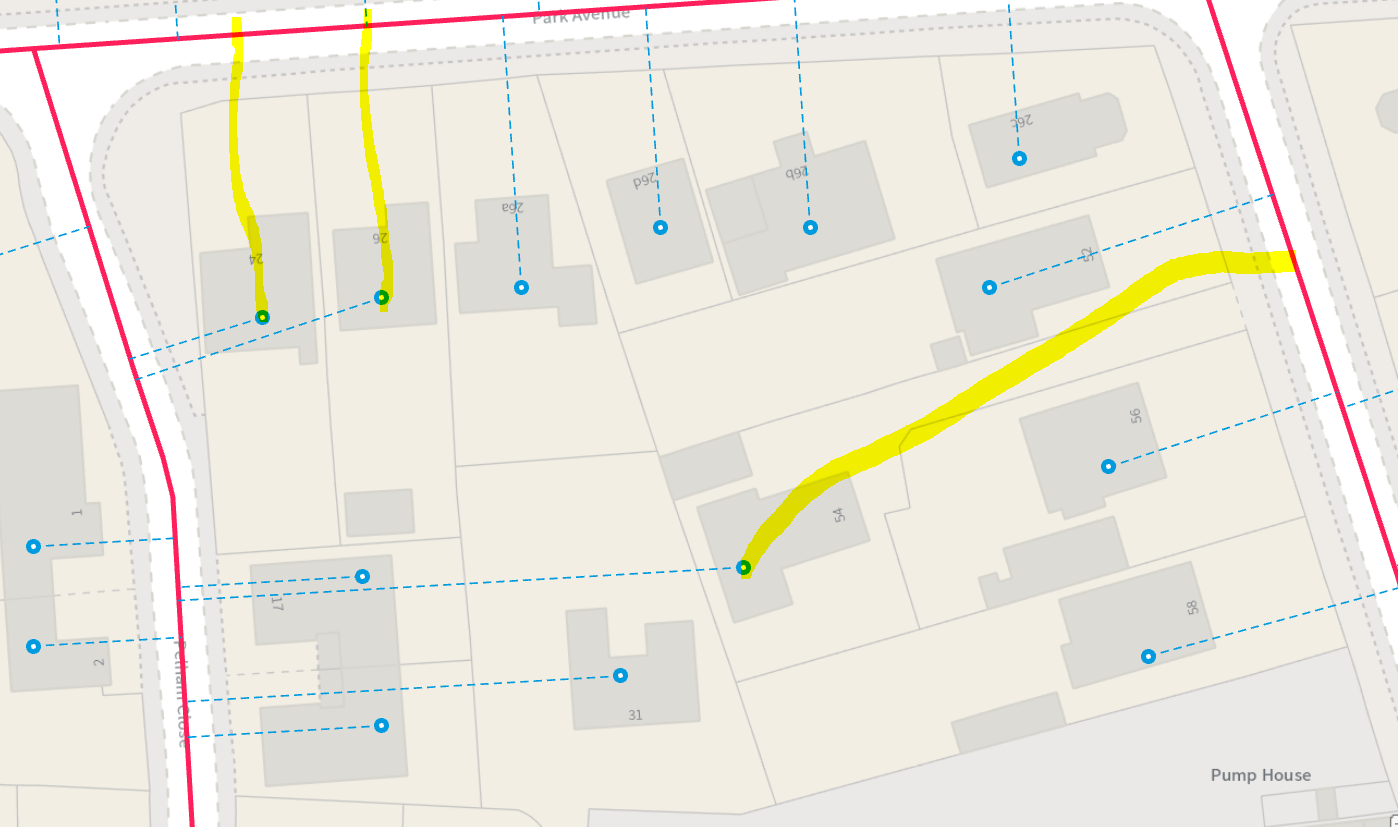
The image below shows the results i am getting with the Yellow lines drawn on where the links should be going.

image 

Thanks in advance...

icon

Best answer by virtualcitymatt 28 October 2021, 12:00

View original

3 replies

Userlevel 4
Badge +26

You need to use the Group Processing option - group by the ID. It's the top checkbox which is off by default

Userlevel 4
Badge +25

If you don't have an ID that matches the point to the road segment (yes, use the Group By) then it looks like you have the numbers in the building properly rotated and can use them to orient the line direction.

So, in the abstract, expose the rotation of the number text, copy it to the building (PointOnAreaOverlayer) then from there to the actual point (again PointOnAreaOverlayer).

Then use the NeighborFinder and create a list of the results. You can then check if the rotation of the text is approximately aligned to the bearing of each nearest road feature. If it is within (say) 15 degrees, then you've got the correct road.

Badge +9

You need to use the Group Processing option - group by the ID. It's the top checkbox which is off by default

Thanks for your reply, all sorted. The initial data was a bit suspect, now it has been modified all works as expected...thanks again...

Reply