
See attached images. I'm trying to read a Geotiff of an engineering drawing. When I view it in 3Dpaint the pixel values vary between black, grey and white. But when I read it in FME all the pixel values are either black (0,0,0) or white (255,255,255). I want to sharpen the image by filtering out the grey pixels. But how do I read the file to expose the "grey" pixel values?


Userlevel 4
 +30
+30
- Evangelist
- 1880 replies
-
1 October 2021

Hi @eric_armitage
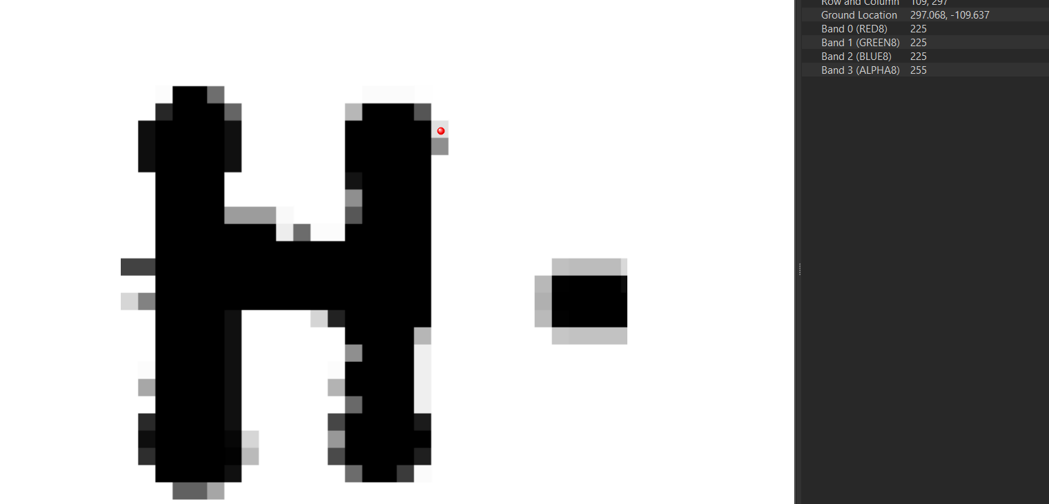
I'm using the FME 2021.1 and I can see the values of gray:
Do you want to turrn these information in attributes?
Thanks in Advance,
Danilo


 +6
+6
- Contributor
- 27 replies
-
1 October 2021
Hi. I think you can see to grey values because you are reading the image created with 3Dpaint. When I read the tiff with FME there is no grey. I think 3Dpaint may be applying some kind of filter to the tiff rather than displaying the original file.


Userlevel 5
+25
- Influencer
- 3345 replies
-
4 October 2021

Hi. I think you can see to grey values because you are reading the image created with 3Dpaint. When I read the tiff with FME there is no grey. I think 3Dpaint may be applying some kind of filter to the tiff rather than displaying the original file.
If 3DPaint is really adding that anti-aliasing then I'm afraid FME won't be able to read those grey pixels on account of them not actually being in the file. Any chance you can share (a small part) of that original GeoTiff here?
+6
- Contributor
- 27 replies
-
8 October 2021
I managed to clean up the image using the rasterconvolver and the raster expression evaluator. I think FME was reading the file correctly and 3D paint was automatically applying a blur filter which was confusing me.
Reply
Enter your username or e-mail address. We'll send you an e-mail with instructions to reset your password.