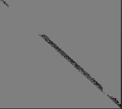
 Hey everyone, new to FME. Not a professional in GIS, so please excuse my lack of knowledge on terminology. I'm using this guide and I've followed the instructions, as well as downloaded the provided workbench file, but for some reason, I can't get my .LAS/.LAZ files to convert properly. Using the first method from the guide yields the weird image above. Does anyone know what's wrong? I've tried this with a few files and it doesn't seem that my files are the issue. I've uploaded the project file to this post.

Converting .LAS/.LAZ files to DSM/greyscale images


 +4
+4
- Contributor
- 51 replies
-
1 June 2021

 @siyengar ,
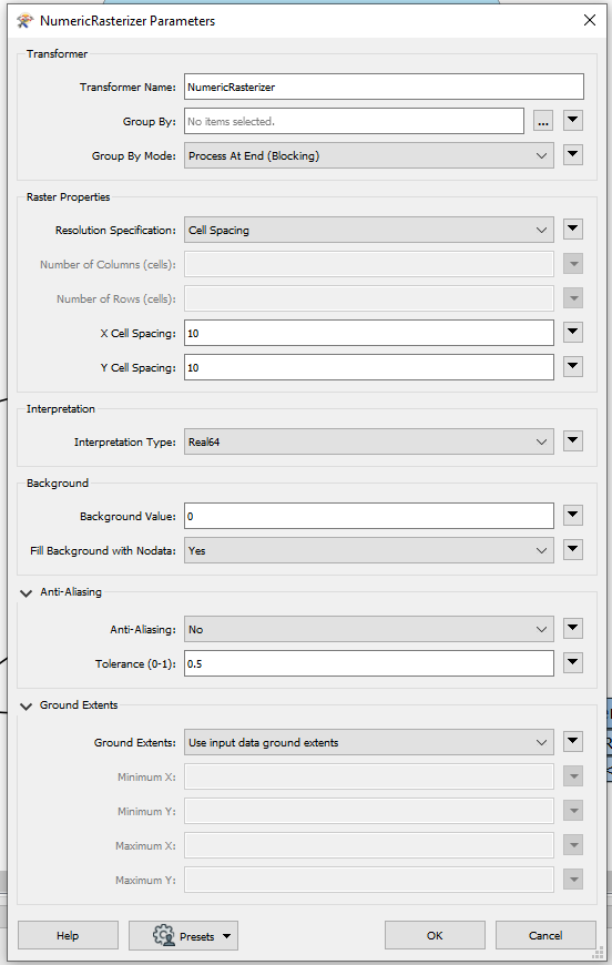
just replace imageRasterizer with numericRasterizer |
@siyengar ,
just replace imageRasterizer with numericRasterizer |
That's a little better, thanks @canerakin . However, I want to preserve overhang - like bridges and highways, in the image. Is that possible? Also, the resulting image seems to be quite low-res.
+4
- Contributor
- 51 replies
-
2 June 2021
Are they vectoral data or are they part of the point cloud?
If they are vector data, check out the tutorial below. This tutorial shows many examples of raster conversions. To increase the quality decrease the cell spacing or switch to "Rows and Columns" in the resolution specification of the numericRasterizer and set high numbers.
https://community.safe.com/s/article/converting-vector-data-to-raster
All of the data I'm working with here comes from a .LAS file, which is part of a point cloud, not vector data, I think. That helps solve my resolution problem, thanks. However, I want to use this in Blender to render a point cloud, and directly importing a point cloud is not viable due to performance. That being said, do you happen to know how to convert it into a greyscale image, while also preserving where there is overhang?


Userlevel 1
 +10
+10
- Safer
- 371 replies
-
4 June 2021

In the article you were originally looking at (https://community.safe.com/s/article/creating-a-raster-from-a-point-cloud), I'm wondering if you tried the approach using the RasterDEMGenerator, wondering if this would be a more appropriate method for what you're trying to achieve?
In the article you were originally looking at (https://community.safe.com/s/article/creating-a-raster-from-a-point-cloud), I'm wondering if you tried the approach using the RasterDEMGenerator, wondering if this would be a more appropriate method for what you're trying to achieve?
I've tried that also, but as stated elsewhere, I keep getting a grayscale that doesn't have a way to preserve where there is overhang like bridges. I'm trying to put this into Blender, and I've heard that a grayscale image is the best option, but I can't seem how to get all the data into a grayscale image while preserving edges and all at the same time.
Reply
Enter your username or e-mail address. We'll send you an e-mail with instructions to reset your password.