Solved

Can I generate n hillshades that use the min and max values from the entire input dataset of n files? (Mosaic not an option)

  • 22 April 2021
  • 2 replies
  • 0 views

Badge

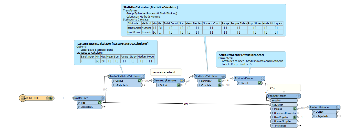
I have a folder of ~300 2gb DEM files. I want to produce hillshades of these 300 individual tiles so that when viewed together the colour ramp is the same across file boundaries.


Rasterhillshade doesn't work well if the min-max values on a file is 5m-300m and the adjacent file is 5m-900m.


I've previously put DEMS through a raster mosaic and then produced a hillshade but with this size of data that's not feasible.


Any ideas how this can be done?

icon

Best answer by hkingsbury 26 April 2021, 22:12

View original

2 replies

Userlevel 5
Badge +29

I think you're going to run into problems with the RasterHillshader as it doesn't let you specific min/max values.

However, to get the min/max of all your rasters you can get your min/max values for each raster, and pass them through a RasterStatsCalc then through a GeometryRemover (to remove the raster band to help with speed) then through a StatsCalc to get the largest max and the smallest min. Then merge the Summary feature back onto the individual rasters.


Screenshot 2021-04-27 081228

Badge

Hello and thank you!

This works really well on a test group of tiles. I didn't think of using the feature merger to provide min and max values to the hillshader but it seems to do the trick.


To speed things up on the statistics calculator what I've done is used a creator > attribute creator to make a band0.min.min and a band0.max.max with the values that I know are the min and max obtained by putting the tiles that should contain the lowest point (-15.348) and highest point (851.525) across the input dataset though the statistics calculator part of the workflow. (Obviously unexpected or erroneous data would be missed but this shouldn't be too much of an issue.)


Thanks once again for the help with this.

Alex

Reply