
Hi everyone,
Apologies if I'm asking in the wrong section, but I've been stumped with a geospatial problem and I have no idea where to even begin solving it.
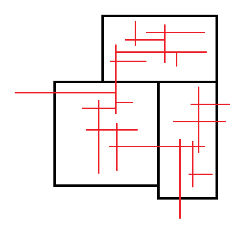
I'm working on a project where I have a bunch of lines inside of polygonal land parcels. Here's a rough sketch of what I'm talking about:
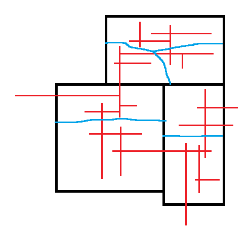
 I need to further subdivide these parcels into sections that contain ~80km of line each, while trying to maintain line connectivity as much as possible. So as an example, I'd want the finished subsections to look like this (very rough) sketch here, where the blue line represents the boundary of each subdivided polygon that contains ~80km of line:
 I've used FME a fair amount, but I have no idea where to even start creating a workflow that can handle this. I know I can use LengthCalculator to get length attributes for each line, but I'm completely clueless on where to go after that. If I can get the lines selected and attributed into discrete groups using length totals, I think I can probably cook up a solution using buffers or Thiessen polygons, but I'm completely stumped how to even get there.
Thanks for your time.
