I have a CSV file with Lat/Long for a point features and String for radius of exposure, I wish to create buffer for each well since their radiuses are different, I followed a tutorial but all the buffer went to one single point. Each point has 3 different radius, so I need to do this 3 times. In the attached tool I only used one radius at a time, this is for sensitive radius. The lat log is originally stored in NAD27 DD.

Hello @juhaszvanda,
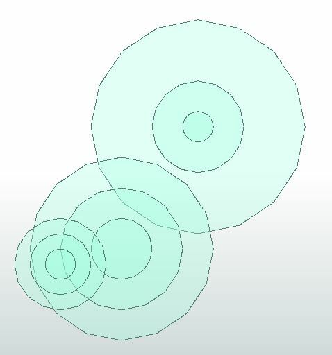
Unfortunately, I couldn't open your workspace. Some weird error occurred, so I created some dummy, ad hoc, values. Will this approach work for you?
The result is as follows:
 +2
+2
Hi @juhaszvanda,
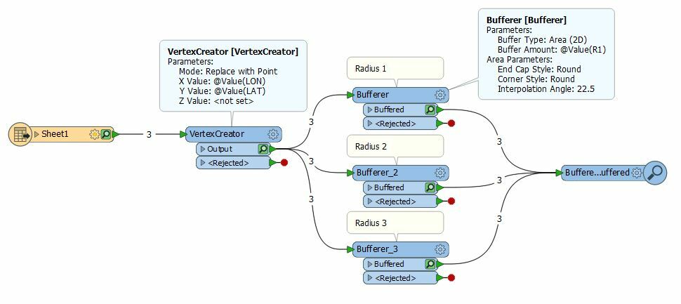
There is also a custom transformer - the MultiBufferer that will allow you to do this in a single transformer. It only uses a single buffer interval so will only be useful if desired outcome buffers are equal distances apart.
You can find the transformer documentation here: https://hub.safe.com/transformers/multibufferer
buffers-for-points-test-with-kfigur.fmwtestrv.csv
kfigur,
Thank you for your suggestion. I created the same WP as you and ended up with the same result. I attached the CSV this time. Could you take a look please.
Thank you, Vanda
+2
buffers-for-points-test-with-kfigur.fmwtestrv.csv
kfigur,
Thank you for your suggestion. I created the same WP as you and ended up with the same result. I attached the CSV this time. Could you take a look please.
Thank you, Vanda
Unfortunately your workspace is still unavailable :
Using the test data you provided this gives me the following result:
Dear @hollyatsafe
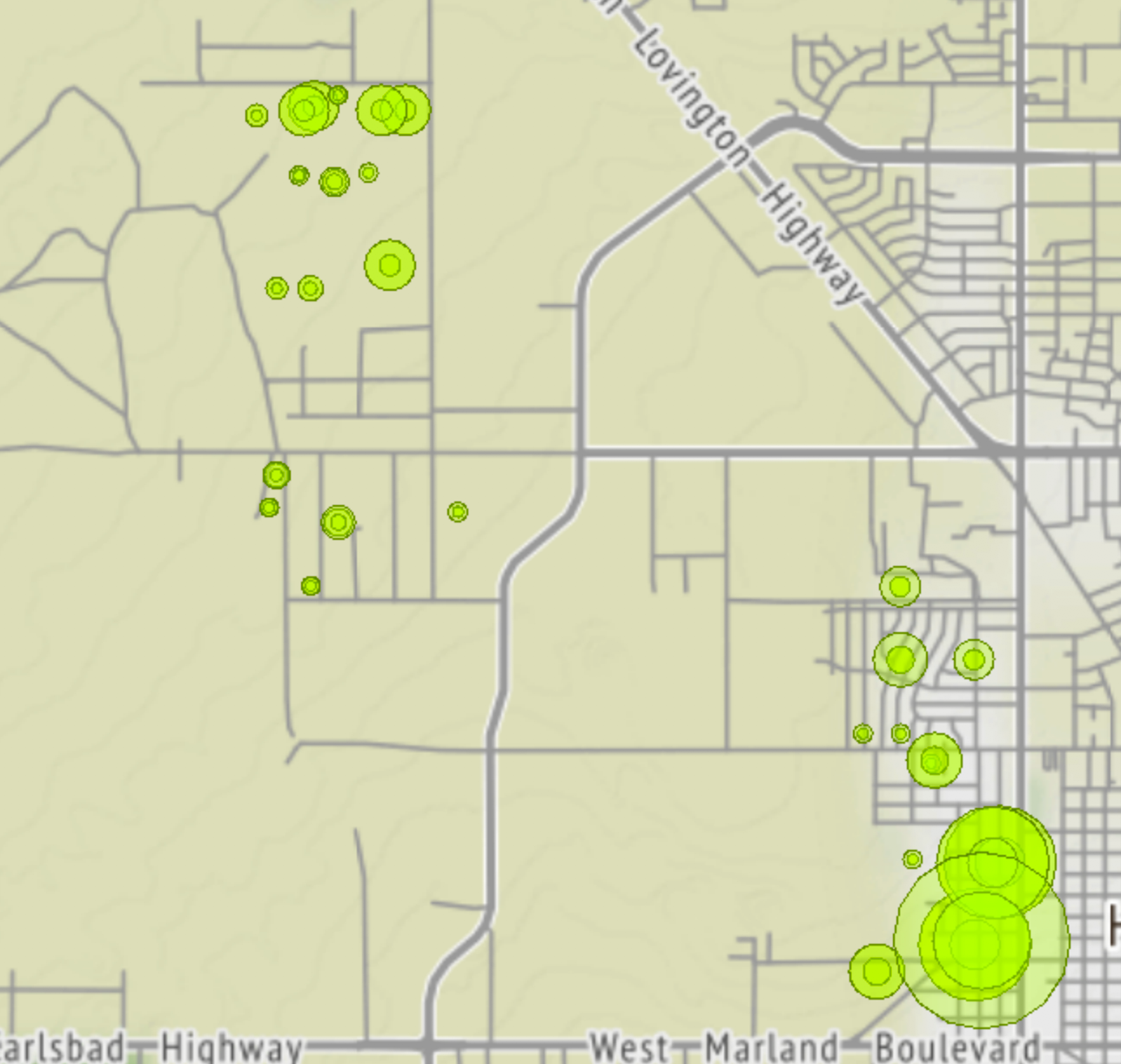
Thank you very much for looking into my issues. I did what you suggested and ended up with the wrong result again. So, here are some question where I think I might making a mistake.
When I bring in the CSV file, I set the Parameters - chose Manual and set Lat and Long as Y coordinate and X coordinate and not a string. Is this necessary or not?
Next, where the data originates its stored in GCS_North_American_1927. This is what I need to set in the CSV file when I added as a Reader?
If I set the coordinate system in the Reader why do we need the CoordinateSystemSetter? I thought FME can read the source data CRS and use the same throughout the who calculation.
I attached a Word document with screenshots and I used my Grant program licence to re-creach the WS, hopefully this time will work.
Thanks again for the help. @juhaszvandascreenshots-for-holly.ziptest-with-holly.fmw
+2
Dear @hollyatsafe
Thank you very much for looking into my issues. I did what you suggested and ended up with the wrong result again. So, here are some question where I think I might making a mistake.
When I bring in the CSV file, I set the Parameters - chose Manual and set Lat and Long as Y coordinate and X coordinate and not a string. Is this necessary or not?
Next, where the data originates its stored in GCS_North_American_1927. This is what I need to set in the CSV file when I added as a Reader?
If I set the coordinate system in the Reader why do we need the CoordinateSystemSetter? I thought FME can read the source data CRS and use the same throughout the who calculation.
I attached a Word document with screenshots and I used my Grant program licence to re-creach the WS, hopefully this time will work.
Thanks again for the help. @juhaszvandascreenshots-for-holly.ziptest-with-holly.fmw
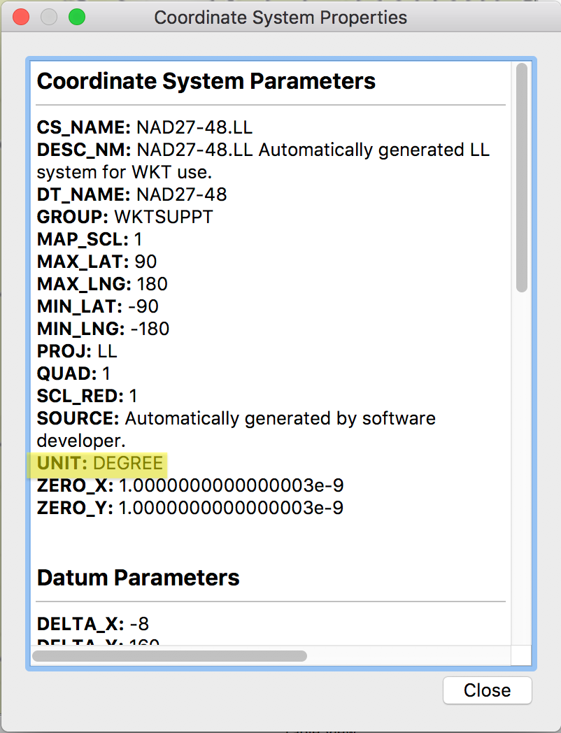
No problem. Yes you have set up the VertexCreator correctly and if you set the Coordinate System in the CSV reader then it is not necessary to also use a CoordinateSystemSetter. The problem is that NAD27-48.LL is recorded in degrees:
You have two options to get the desired result:
a) Reproject the data to a new coordinate system after the VertexCreator using a Reprojector - this will plot the points in a coordinate that carries the correct unit for the unit needed in the Bufferer.
b) Instead of the Bufferer use the GeographicBufferer. This does the same thing as the bufferer but allows you to set a Buffer Distance Unit different to that of the CoordinateSystem.
If you want to use a lat/long projection then option B is the best way to go for you. You can get more information about the GeographicBufferer and where it differs from the Bufferer here: https://docs.safe.com/fme/html/FME_Desktop_Documentation/FME_Transformers/Transformers/geographicbufferer.htm
Please find attached an altered workspace with the two options (this assumes the measurement unit is meters) .
test-with-hollyv2.fmwt
Reply
Enter your username or e-mail address. We'll send you an e-mail with instructions to reset your password.