
I want to calculate the cell distances between all cells within a feature class grid. Exactly the same as the game Minesweeper
I currently have the cells as a feature class within an esri file geodatabase, but can easily convert it to a raster grid.
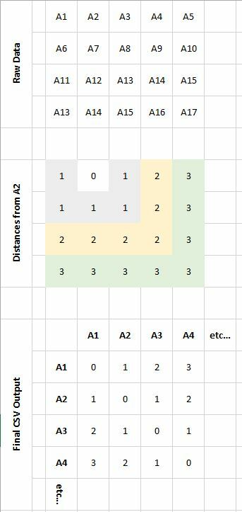
I have included an example below. The original data contains 11000 cells with different labels but I have simplified in the example:
For each cell I want to find how many cells apart they are from all other cells.. Example here is for cell A2. I would then iterate this for every cell in the grid to produce the final csv.
I have attempted using cost distance tools within a GIS, but It's unable to cope with the data.
I have access to FME 2014, but looking through the help files I've been unable to find a way to do this.
Is anybody able to give me some guidance as to how this may be achieved?
Many thanks


