
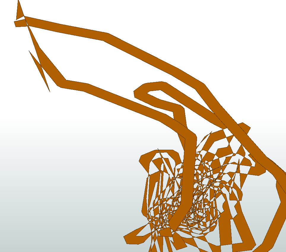
Hi, we have several data sets where GPS software incorrectly handles overlapping tracking data that is buffered.
Any suggestions on how this might be recovered?
Note we don't have the raw data or centre lines
Thanks
Brian

Hi, we have several data sets where GPS software incorrectly handles overlapping tracking data that is buffered.
Any suggestions on how this might be recovered?
Note we don't have the raw data or centre lines
Thanks
Brian


 +25
+25
It's FME art!
All kidding aside... is there any way to get hold of the original track (the line)? This looks like a big mess and I'd be very weary to try and clear that up with FME.

It's FME art!
All kidding aside... is there any way to get hold of the original track (the line)? This looks like a big mess and I'd be very weary to try and clear that up with FME.
 +25
+25
Yikes, that is horrific. I don't know that you could automate anything that would better than trying to manually recover the content. For example, you could use the CentreLineReplacer to get some parts, and you could even perhaps replace both the brown parts and the empty space in between, but then it would need a manual cleanup.
If you knew the buffer size, say it was 10 metres, you could buffer it to -10 metres in FME and see what you get. Again, that's only going to get you so far.
If we had a rough idea of what the source data looked like, we might be able to figure out what the GPS software had done to it, and reverse engineer that process. But it's hard to look at that and see an obvious pattern.
The key issue is that where the track polygon overlapped another track polygon instead of aggregating it is removing. Not easy to detect from that mess, it was the worst case I had found and probably not particularly helpful.
I have gone the other way and buffered by 6m and then buffered by -6m. That will serve for our purposes. Altho FME really doesnt like the geometry.
Cheers
Brian
Enter your username or e-mail address. We'll send you an e-mail with instructions to reset your password.

