I have 2 polygons, example 1 circle and 1 square..they overlap, what transformer do I use to cut the overlap and leave the unoverlapped part? I tried using CLIPPER but it did not work.

I have 2 polygons, example 1 circle and 1 square..they overlap, what transformer do I use to cut the overlap and leave the unoverlapped part? I tried using CLIPPER but it did not work.


 +18
+18
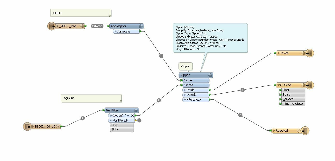
the clipper should work. If I look at the screen-shot you probably have to swap the clipper and clippee port connections. Are both datasets in the same projection?
I tried swapping them around but it doesn't clip...the output tends to be just the square.

 +2
+2
Hi,
Have you placed the inspector at each step and checked where the data is overlapping?
If yes and still not identified the reason then its better if you can post sample data or screenshot for better understanding of your question


I see you have set Clippers First, are you sure this is really the case in your workspace? Try turning it off and see if it helps.
David
I see you have set Clippers First, are you sure this is really the case in your workspace? Try turning it off and see if it helps.
David
Also, what is the purpose of the Aggregator here? Are you sure you need it?
 +3
+3
remove aggregator.
..is that 1 circle? With a huge amount of vertices/linesegments?
Then either extract center, begin and endpoint and then use a 2dArcReplacer to turn it in to a more manageable resolution.
Or a linejoiner, if they are lines and then generaliser. (i would do first suggestion tho).
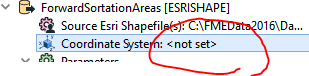
I am getting this warning in relation to the coordinate system.. how do i define the coordinate systems so they align in this case?
2016-04-15 15:01:34| 0.4| 0.0|WARN |FME does not support MapInfo datum `9999,0,0,0,0,-0,-0,-0,0,0' -- assuming default of WGS84
2016-04-15 15:01:34| 0.6| 0.0|WARN |NOT changing coordinate system of reader identified by keyword `MAPINFO_1' from `EPSG:4283' to `_MI_0' -- mapping file setting of `EPSG:4283' overrides coordinate system `_MI_0' read from file
what transformer can i use to make them both EPSG:4283?

 +13
+13
There may be several problems in play here, but another is that you're using a Group By . For your example I'd suggest you'd not want this. You've got it set to put all clippers and clippees into separate bins based on the value of fme_feature_type. Since the clippers have a different feature type than the clippees, they will be in different "bins" and not processed together. So nothing useful will happen. Also the clipper/clippee appear to need swapping. And I'd lose the aggregator as well, likely not needed.
+18
I am getting this warning in relation to the coordinate system.. how do i define the coordinate systems so they align in this case?
2016-04-15 15:01:34| 0.4| 0.0|WARN |FME does not support MapInfo datum `9999,0,0,0,0,-0,-0,-0,0,0' -- assuming default of WGS84
2016-04-15 15:01:34| 0.6| 0.0|WARN |NOT changing coordinate system of reader identified by keyword `MAPINFO_1' from `EPSG:4283' to `_MI_0' -- mapping file setting of `EPSG:4283' overrides coordinate system `_MI_0' read from file
what transformer can i use to make them both EPSG:4283?
You can use the CsmapReprojector- or the Reprojector-Transformer.
You can set the projection of the reader and/or writer also.
Enter your username or e-mail address. We'll send you an e-mail with instructions to reset your password.


