Question

Aggregating Point Dataset


Badge

Hey all,

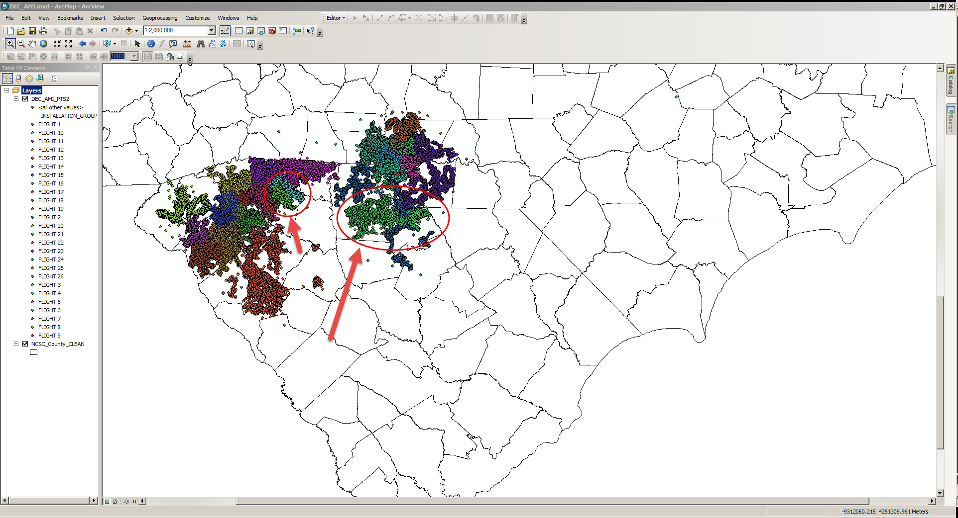
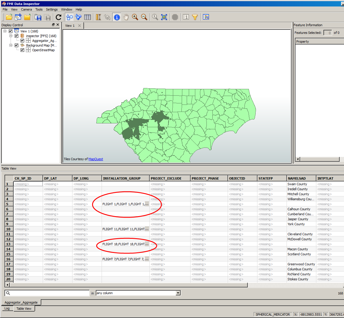
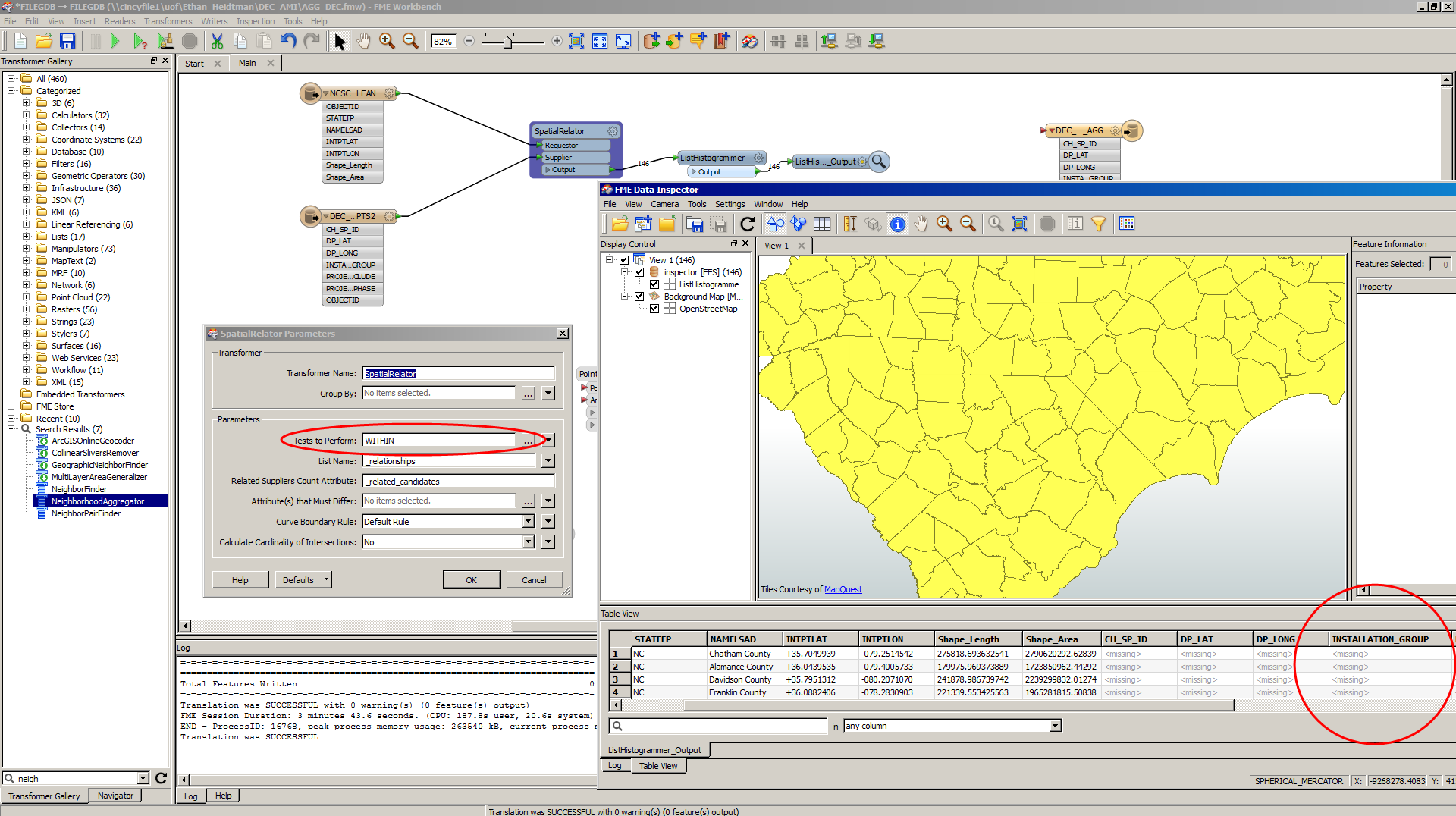
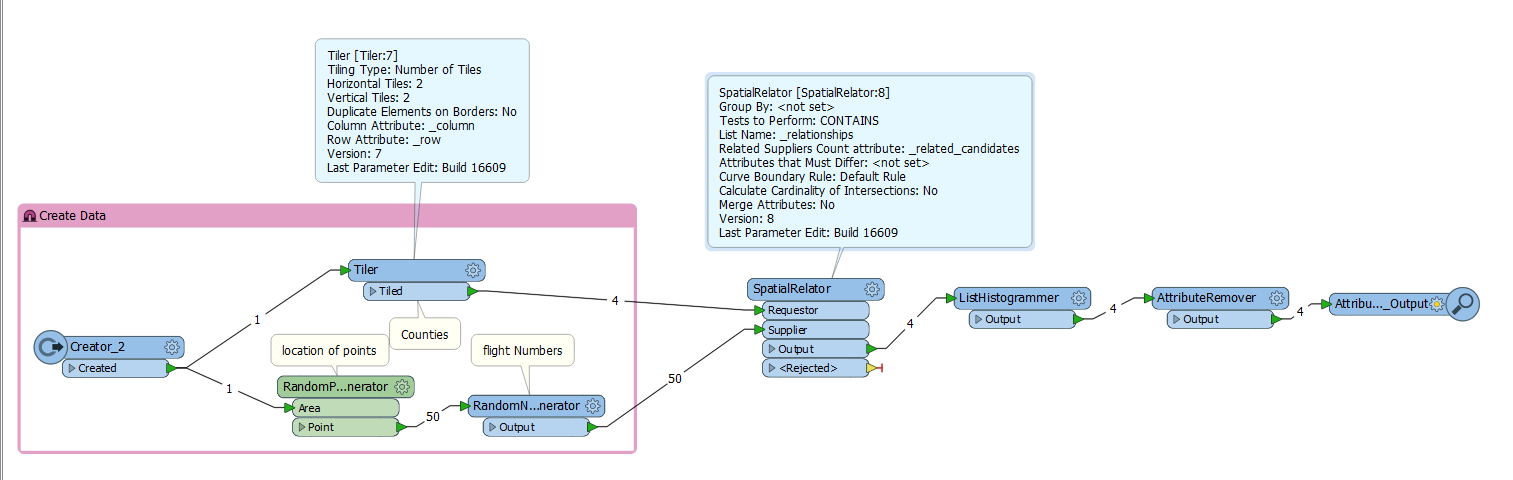
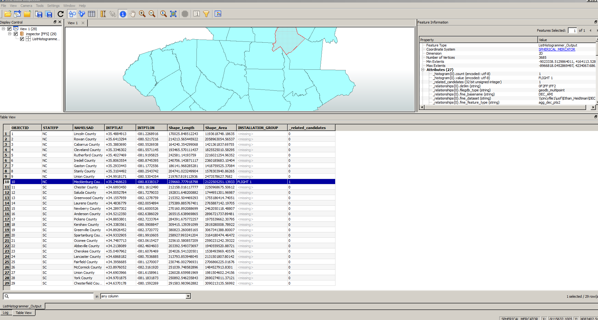
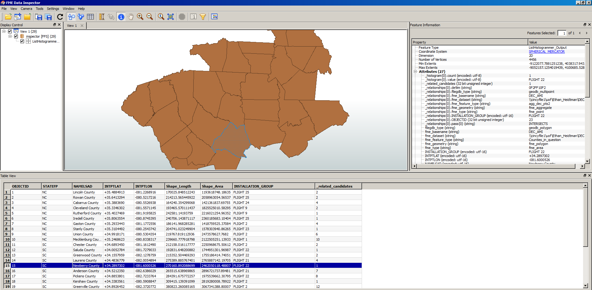
I have a point dataset with over a million points. However, I am trying to aggregate them based on their flight number. The thing is some of the points have the same flight number in different counties, so I dont want to use a hullaccumulator because that would take in to account empty areas or areas with other flights present. I have tried transformers like the neighborhood aggregator, I am just unsure how to go about this.I just dont want ArcMap to have to draw over a million points every time I pan to a different area. Any ideas? I have attached an image of what I mean.

thanks in advance!


26 replies

Userlevel 5
Badge +25

If you do a PointOnAreaOverlayer of the points with the counties you can get the county name (assuming you have that in an attribute) as an attribute of the points, then aggregate them on flight number and county name, that way you'll get an aggregate for all unique combinations of those two attributes and if you accumulate hulls they'll be smaller areas.

Badge

If you do a PointOnAreaOverlayer of the points with the counties you can get the county name (assuming you have that in an attribute) as an attribute of the points, then aggregate them on flight number and county name, that way you'll get an aggregate for all unique combinations of those two attributes and if you accumulate hulls they'll be smaller areas.

Wow, thanks for the timely response.


My county data is in a different shapefile not associated with the point data. Will that matter?


The analysis I am doing is what different flight numbers fall within each county.
Badge

What I want to know is all the different flight numbers that fall within each county. If I aggreage based on flight number and county name I only get the unique combinations.

Userlevel 5
Badge +25
Wow, thanks for the timely response.


My county data is in a different shapefile not associated with the point data. Will that matter?


The analysis I am doing is what different flight numbers fall within each county.
That's no problem, just add another reader for that county shapefile.


Userlevel 5
Badge +25

What I want to know is all the different flight numbers that fall within each county. If I aggreage based on flight number and county name I only get the unique combinations.

You can set the Aggregator to concatenate the flight number attributes into a new one, so per county you get a list of flight numbers (with a separator character of your choice)


Badge +22

Are you actually interested in keeping the point geometry in any way, or is it sufficient to have the unique flight numbers for each county on the county geometry?


If the latter then a SpatialRelator (Counties as Requestor) followed by a ListHistogrammer (on _relationships{}.flightnumber will give you a list of all the flight numbers that fall inside the county (and how many times for each flight number).
Badge
You can set the Aggregator to concatenate the flight number attributes into a new one, so per county you get a list of flight numbers (with a separator character of your choice)


awesome!! thank you very much!


Is there a way to make the flight numbers not repeat? i.e. "Flight 1" Only appears once in the cell.


Badge
awesome!! thank you very much!


Is there a way to make the flight numbers not repeat? i.e. "Flight 1" Only appears once in the cell.


oh wait nvm, i did something wrong. the flight numbers arent associated with the county names because they fall within more than one county.... hmmmmmm.
Badge

Are you actually interested in keeping the point geometry in any way, or is it sufficient to have the unique flight numbers for each county on the county geometry?


If the latter then a SpatialRelator (Counties as Requestor) followed by a ListHistogrammer (on _relationships{}.flightnumber will give you a list of all the flight numbers that fall inside the county (and how many times for each flight number).
I only really need the point geometry for a visual representation. I will try this spatialRelator for the analysis portion. thank you for your response.
Badge

Are you actually interested in keeping the point geometry in any way, or is it sufficient to have the unique flight numbers for each county on the county geometry?


If the latter then a SpatialRelator (Counties as Requestor) followed by a ListHistogrammer (on _relationships{}.flightnumber will give you a list of all the flight numbers that fall inside the county (and how many times for each flight number).
Do you know if I am setting the parameters up wrong?


Badge +22
Do you know if I am setting the parameters up wrong?


It should be CONTAINS.


Badge

Ok, so I aggregated my point dataset (flight numbers) from over a million to just 26 multi point features.

I am now confused.

My end goal is to have a data set that lists each county name with the various flight numbers contained in that county.

I imagine this is going to be some sort of spatialfilter -- or point on area overlayer-- i just cant seem to get the parameters correct.

any thoughts?

Badge +22

Ok, so I aggregated my point dataset (flight numbers) from over a million to just 26 multi point features.

I am now confused.

My end goal is to have a data set that lists each county name with the various flight numbers contained in that county.

I imagine this is going to be some sort of spatialfilter -- or point on area overlayer-- i just cant seem to get the parameters correct.

any thoughts?

The attached workspace should illustrate how to get for each county, the list of all the flight numbers that fall within that county.


flightscounties.fmw


Badge
The attached workspace should illustrate how to get for each county, the list of all the flight numbers that fall within that county.


flightscounties.fmw


I am using FME 2014 idk if that is why it isnt showing up. I tried to do what you explained in your first post, but it was only giving me counties that had one flight number contained. If the county has multiple flight numbers contained it would be null.


this is what the workspace you sent looks like for me.

Badge +22


I am using FME 2014 idk if that is why it isnt showing up. I tried to do what you explained in your first post, but it was only giving me counties that had one flight number contained. If the county has multiple flight numbers contained it would be null.


this is what the workspace you sent looks like for me.

Yes, I don't have 2014 on this machine, and there have been updates to those transformers in the intervening years. I've attached summary annotations to the missing transformers, which should help you rebuild it.

Badge
Yes, I don't have 2014 on this machine, and there have been updates to those transformers in the intervening years. I've attached summary annotations to the missing transformers, which should help you rebuild it.


thanks for all your help, i truly appreciate it.


however, something is not right. when I run that my flight numbers are not making it to the inspector after the listhistogrammer, only the counties shapefile. ......


Badge +22
Yes, I don't have 2014 on this machine, and there have been updates to those transformers in the intervening years. I've attached summary annotations to the missing transformers, which should help you rebuild it.

What is the test you are using in the Spatial Relator?


Badge
Yes, I don't have 2014 on this machine, and there have been updates to those transformers in the intervening years. I've attached summary annotations to the missing transformers, which should help you rebuild it.


Tests to perform? I am using contains.
Badge +22
Yes, I don't have 2014 on this machine, and there have been updates to those transformers in the intervening years. I've attached summary annotations to the missing transformers, which should help you rebuild it.

Based on the number of features, it looks like you have already aggregated your points. In that case there probably won't be any counties that completely contain your aggregate. Either use the original individual point data, or use Intersects as your test.


Badge
Yes, I don't have 2014 on this machine, and there have been updates to those transformers in the intervening years. I've attached summary annotations to the missing transformers, which should help you rebuild it.


only one flight is being returned

Badge
Yes, I don't have 2014 on this machine, and there have been updates to those transformers in the intervening years. I've attached summary annotations to the missing transformers, which should help you rebuild it.

Ok, so the intersect populated them all. But some counties should have more than one flight associated. Is there some way to concatenate all flights into that field.
Badge +22
Yes, I don't have 2014 on this machine, and there have been updates to those transformers in the intervening years. I've attached summary annotations to the missing transformers, which should help you rebuild it.

Can you display the contents of the agg_dec_pts2 file as well?


Badge
Ok, so the intersect populated them all. But some counties should have more than one flight associated. Is there some way to concatenate all flights into that field.

this is the intersect


Badge +22
Yes, I don't have 2014 on this machine, and there have been updates to those transformers in the intervening years. I've attached summary annotations to the missing transformers, which should help you rebuild it.

You will have one random entry in the InstallationGroup, what you want to look at is the _histogram list, which will contain them all.


You can concatenate the histogram{}.value into a single attribute with the listConcatenator
Badge


only one flight is being returned

here ya go


Reply