Question

How to handle AutoCAD .DWG source file with unknown projection?

  • 25 February 2013
  • 3 replies
  • 14 views

I am building a command line driven translation from AutoCAD .DWG file to Adobe Geospatial .PDF.  My end users are uploading the .DWG file(s) to me.


Can anyone help me with my question.  Do I have to force the end user to supply the .DWG file in a specific projection, or is there a way to run the workspace as having the source projection "UNDEFINED" ?


I have tried the follow:


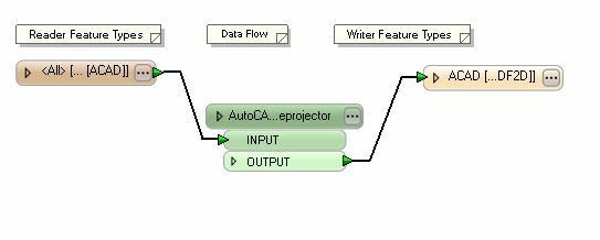
Now, I have modfied and tested my workspace because the supplied .DWG file I am using I know has been created with the projection of  "Pennsylvania State Plane South 83 Feet"   I know that by defining the souce project as this value, I can acheive the desired PDF result.  


However, if I use either "UNDEFINED" or "UNDEFINED-FOOT", I end up in the middle of the earth (which is obviously not desired)


Therefore, my question is how would I take my workspace and modify it so that it can be flexible enough to handle any source projection?  


I have tried to link to my workspace as well with the link below.  It is currently built with the source being "UNDEFINED-FOOT".


http://mapping.pa1call.org/images/fme/Direct-acad2pdf2d.fmw


I hope that you get this message and that it makes sense to where I am at a road block. I look forward to hearing from you as I hope that this is something simple I am just not realizing.


Thanks again in advance!

3 replies

Badge +14
A possible solution could be to publish the source coordinate system parameter and make this a mandatory field for the user to fill in. That way you always guarantee that the imput that is uploaded has the coordsys defined. You could even restrict the possible coordsys list to a handful of options if you only want to suppport certain coordinate systems.


Sorry, I can't download your workspace.
Hi Dave,


Thanks for the quick reply.  Yes, I am beginning to think that we are just going to have to upfront tell our end users that if they are going to upload a .DWG file, then they have to provide it in a specific projection.


I was hoping that somehow using the "UNDEFINED" or "UNDEFINED-FOOT" would work; however, I had no luck.  I apologize for the workspace link not working; however, at this point there is no worries about downloading it.  


I now understand that this piece of information either needs to be defined by the end user selecting their projection from a list, or perhaps on my end I force the end user to use one specfic projection.


Thank you for you the help in clarifying that I am not missing anything important. I appreciate it.


Have a good day!


Dave,


I am forcing my end user to put their AutoCAD .dwg file into a specific projection "Lat/Long NAD83" before uploading to my server.  This resolves the issue and thank you for all your help. 


I really appreciate it. Have a good day.


Nick

Reply