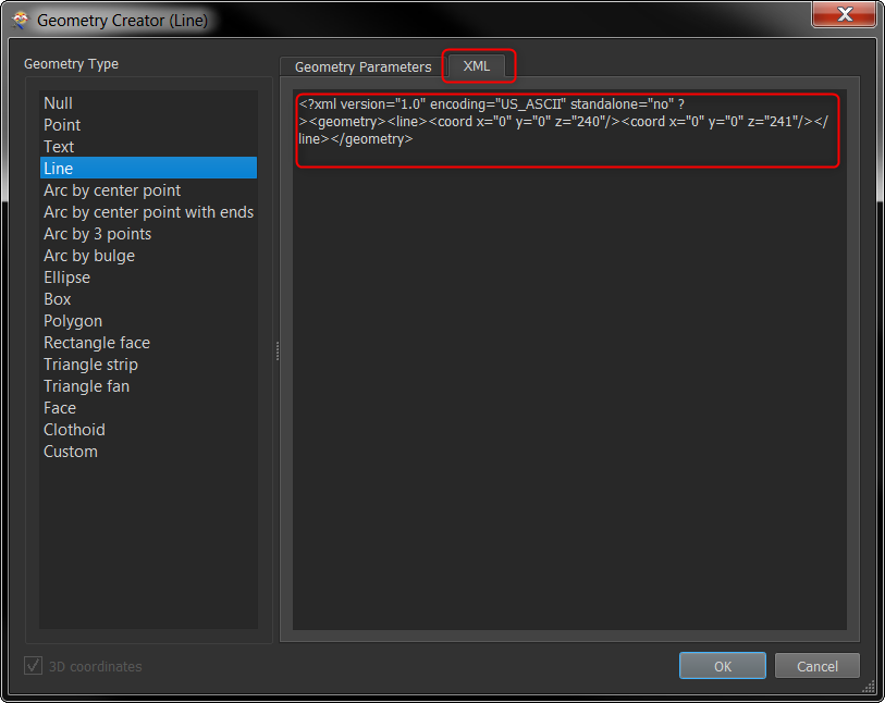

How this can be achieved in FME?
https://support.esri.com/en/technical-article/000011817
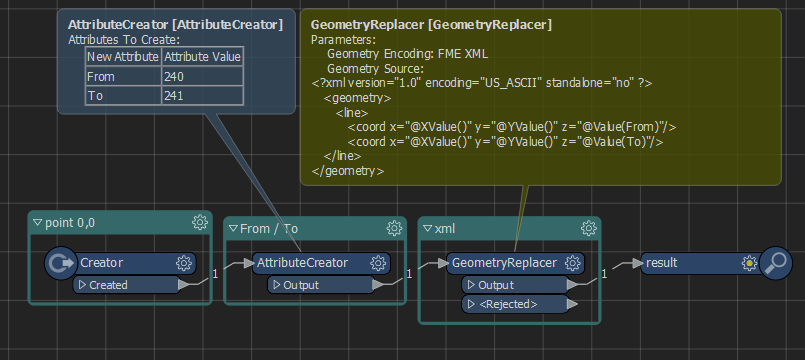
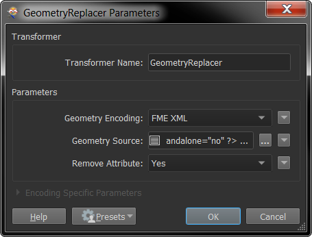
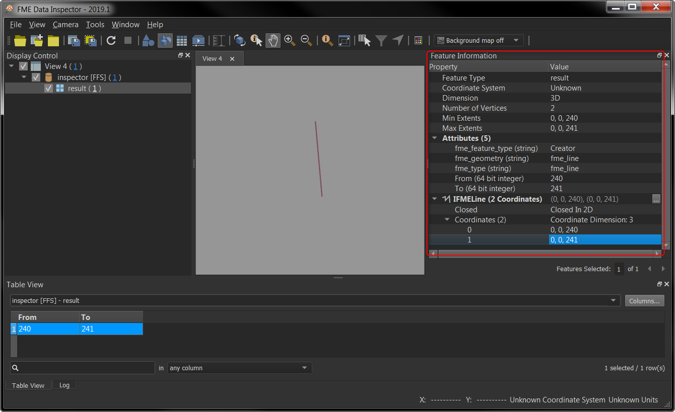
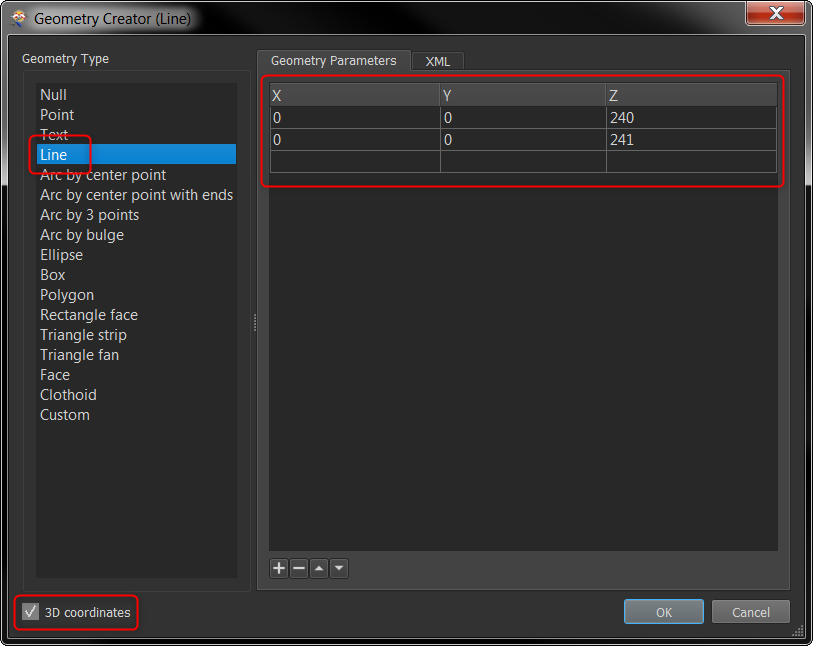
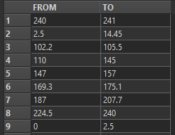
Source data – 2D point geometry with attributes 'FROM' and 'TO' (elevation values stored). The goal is to create 3D lines from those values.
Best answer by nielsgerrits
View original