
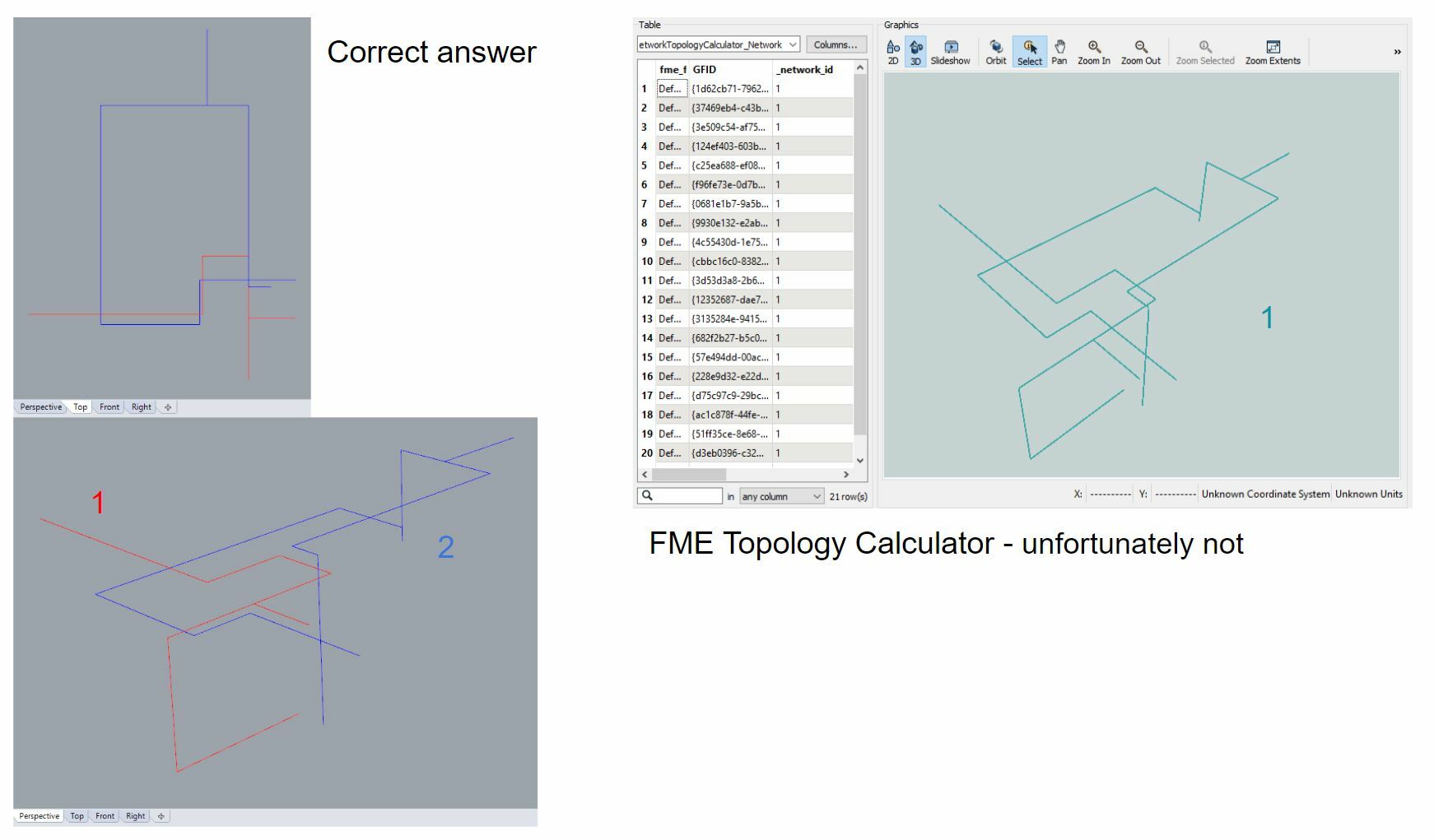
Hi, I have a road network that I've been using the NetworkTopologyCalculator on to identify unconnected roads which I then discard to avoid drivers getting stick on an piece of road.
But, what I've just had pointed out to me is that my method isn't catching all unconnected roads. Some unconnected roads pass under/over the valid road network, touching nodes, which the
NetworkTopologyCalculator assumes are part of the valid road network. I have an elevation indicator for the start and end of each road segment, so I though by using the 3DInterpolator this would allow the
NetworkTopologyCalculator to identify that the roads were not touching at bridges/tunnels, but this does not seem to be the case.
Has anyone encountered such an issue, and if so are there any tools that might assist me here?
Thanks
Rich.


 Are there any plans to give the 3D part of FME some upgrades?
