Question

Prepare Sentinel-2 on AWS for pre-processing


Badge

Hi folks,

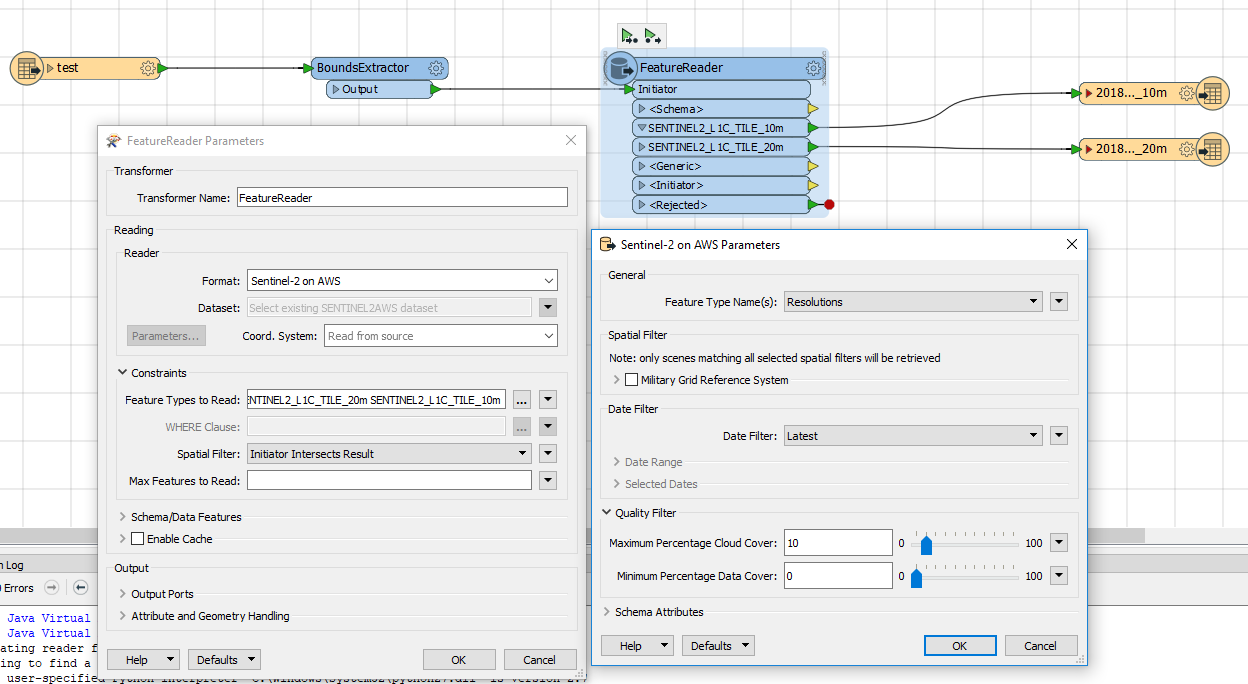
I am using the Sentinel-2 on AWS format within the FeatureReader transformer to download a Sentinel-2 image for a specific area. With the feature types for 10 meters and 20 meters resolution, I want to perform a radiometric/atmospheric correction with SNAP (Sentinels Application Platform). I tried to use the GeoTIFF writer and exposed all the format attributes but that does not seem to be sufficient to fulfill the required meta data.

Can you recommend a specific writer or a workflow to convert the radiance to (corrected) reflection values?

Thanks in advance,

André


5 replies

Badge +7

Hi @abal,


Thanks for your question! I'm not too familiar with all the SNAP tools, but perhaps I can help you find out if FME can get at the data/metadata you need. To start, can you give a bit more detail as to what's missing using the GeoTIFF reader? Is there some documentation from Sentinel that outlines the needed metadata for your SNAP corrections?


Looking forward to learning more about this!


Best,

Nathan

Badge +22

I had much better luck using SNAP with the sentinel 2 data from the copernicus hub then from AWS.

Badge

I had much better luck using SNAP with the sentinel 2 data from the copernicus hub then from AWS.

Yes, unfortunately, I am facing the same problem.


Badge

Hi @abal,


Thanks for your question! I'm not too familiar with all the SNAP tools, but perhaps I can help you find out if FME can get at the data/metadata you need. To start, can you give a bit more detail as to what's missing using the GeoTIFF reader? Is there some documentation from Sentinel that outlines the needed metadata for your SNAP corrections?


Looking forward to learning more about this!


Best,

Nathan


Hi Nathan,


Thanks for your help. I have the following set up in FME Desktop 2018.0.0.1 - Build 18295 - WIN64.

The specification of the input data can be found at [1]. The manual for the sen2cor ( Sentinel 2 (atmospheric) Correction) is stored at [2]. My aim is to generate Level 2A products of Sentinel images which includes an transformation from top-of-atmosphere radiance (Level 1C product) to bottom-of-atmosphere reflectance. Therefore I want to use the sen2cor plug-in within SNAP as long as this functionality is not yet provided by FME (maybe excluding using a python script). I think comparing the metadata from Sentinel images from Copernicus Hub could be a good start.


Additionally, you can see that I filtered the Sentinel data by resolution.The 10 meter bands are ordered as follows:


GeoTIFF_band1: Red16 (Sentinel_band4)


GeoTIFF_band2: Green16 (Sentinel_band3)


GeoTIFF_band3: Blue16 (Sentinel_band2)


GeoTIFF_band4: UINT16 (Sentinel_band8)


This is, IMO, very confusing for users which are used to RS software. To generate a CIR image, it is now necessary to set the band order to 4-1-2 instead of the the more intuitive way of band combination 4-3-2 in other RGBI images (for example RapidEye, Landsat7, etc.).


I am exited to hear from you!


Cheers,


André


[1] http://step.esa.int/thirdparties/sen2cor/2.5.5/docs/S2-PDGS-MPC-L2A-IODD-V2.5.5.pdf


[2] http://step.esa.int/thirdparties/sen2cor/2.5.5/docs/S2-PDGS-MPC-L2A-SUM-V2.5.5_V2.pdf
Badge +22
Yes, unfortunately, I am facing the same problem.


What I did was use FME to automatically download the files, unpack them and then run sen2cor via the command line.


I used the Open Access API to determine which files, https://scihub.copernicus.eu/userguide/6OpenSearchAPI via the HTTPCaller.


Processed the resulting data, to filter the files I actually wanted, used the HTTPCaller again to download the files.


and then PythonCaller to run sen2cor, though I suppose you could use the systemCaller.


I recall that I had to create a couple of environmental variables to get sen2cor to run on the commandline, but I don't remember the exact details.


Reply