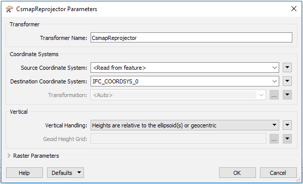
So I have two IFC building models of the same building. One of the models is the actual building the other is the glass shell of the building. When I read the models they get different coordinate system. Now I want to combine them into one model for visualization. To combine the I tried using the reprojector transformer but I couldn't find the other system. How can I reproject between the systems?
Parameters Bellow
CS_NAME: IFC_COORDSYS_0		CS_NAME: IFC_COORDSYS_1
DT_NAME: WGS84			DT_NAME: WGS84
ORG_LAT: 42.41486358638889	ORG_LAT: 48.856666564722225
ORG_LNG: -71.25807189916667	ORG_LNG: 2.3509871958333335
PROJ: AZMED			PROJ: AZMED
QUAD: 1				QUAD: 1
UNIT: MILLIMETER		UNIT: METER
X_OFF: 0.0			X_OFF: 0.0
Y_OFF: 0.0			Y_OFF: 0.0
I have a hard time wrapping my head around how to manipulate the Dynamic coordinate system _AZMED_
Also the BIM-modle is in 3D of course.