Question

Trying to Assign UTM15-IF text coordinate file to raster via RasterGeoReferencer


Badge

I am trying to build a workbench based on Dimitri's rooftop building smart recognition workbench.

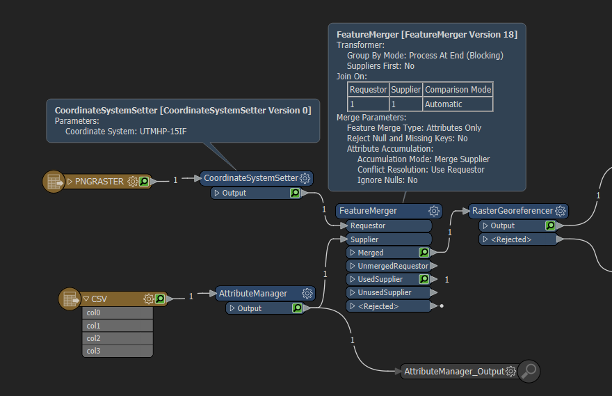
My first step is to use a decent resolution raster file from my GIS software I use. Problem is, it is not georeferenced, but does have a text file with the extension RCT or raster coordinate text. It does not have column names, but I was able to use, with and expert's help, a CSV reader, since it is always space delimited as X left, Y bottom, X right, Y top. But I am getting an error that the @GeoreferenceRaster is failingon the first attribute coordinate, X Upper Left. I have attached a copy of the workbench, PNG file, and RCT coordinate text file. Please note that the raster has an extension of JPG, but is really a PNG.


3 replies

Badge

Files:

Workbench: My Test Roof Recognition Num 2.fmw

Note, had to rename RCT to CSV to work here: gmap0430054310 .csv

Raster: First Sample.jpg


Userlevel 3
Badge +17

Hi @htl

The RasterGeoreferencer expects a raster feature and the feature which contains the raster coordinate text is not a raster feature. As suggested in this other Q&A thread, you can add raster coordinate attributes to the raster feature using the FeatureMerger. Since there are no common keys between the raster coordinate feature and the PNG raster, you can use a hard-coded value in your test workspace.

In addition, instead of using the Reprojector, try using the CoordinateSystemSetter. Reprojection is meant to transform features that are in one coordinate system to another. Since your raster feature does not have a coordinate system when read, the CoordinateSystemSetter would be more appropriate.

Badge

That was much easier to setup and run than I thought. Thanks for the clear steps to perform.

Reply