Best method I've come up with below? Looking for any other experienced REST Raster Image Service users to suggest any better solutions on how to get back 1,000s of raster values in an FME Workflow!
Use case it to query the Surface Levels of anywhere between 1,000 to 1,000,000 geometric points on a REST ESRI Web Image Service that is a 1 metre DEM raster.
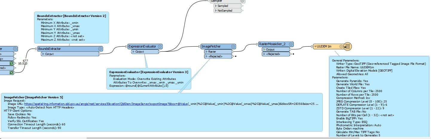
The Server does not allow an HTTP EXPORT request of a JPG/PNG image more than 500x500 pixels, so that kind of rules out just pulling it down with HTTPCaller as a single Raster image and then interrogating that as a Workspace Feature.
I'm a total novice at using an ESRI REST Image Service, but the "best" method I can so far come up is using the IDENTIFY operation:
https://developers.arcgis.com/rest/services-reference/identify-image-service-.htm
Each Operation requires the request to have a single pair of X, Y values for a Point ie. Only one raster value at a time can be called for in an HTTPCaller (and then process the resulting JSON string to pull out the Raster Surface Level value).
So, say 1,000 points would need HTTPCaller to be triggered 1,000 times for the 1,000 sets of Point XYs.
I'm concerned, however that this will lead to QoS / Security measures on either end of the internet/LAN networks that might think my computer is trying to do some sort of Denial of Service attack by FME shooting rapid fire HTTP calls to the same internet domain.....but never having done this before, it might work fine, although chances are it will also not be a very high performance solution either.
Any other suggestions?