Hello,
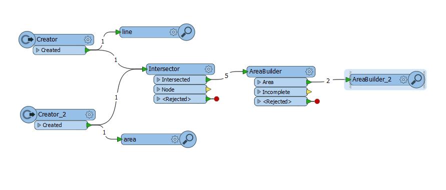
I have a polygon that crosses the dateline.
I would like to split it into two at the dateline, so I even won't need a dateline fix (e.g.https://knowledge.safe.com/articles/34013/dateline-problem.html). My goal is a longitude within -180 and 180 and a correct display on the map using LL-WGS84.
Is this possible? What transformers do I need to use?