Question

Data Harmonization / Generalization

  • 8 October 2013
  • 4 replies
  • 3 views

I have a raster and a vector landcover dataset I want to harmonize in terms of thematic and spatial resolution. The raster dataset is of much higher resolution in both terms.


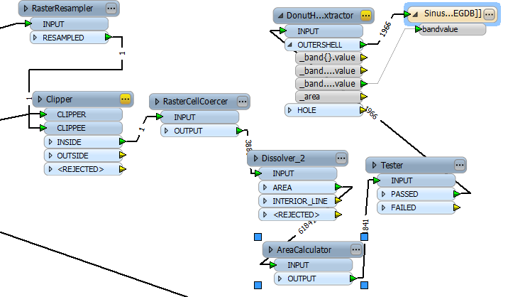
For geometric harmonization I'm using a RasterResampler transformer to get a 100x100 meters spatial resoluton, no big deal.


However, the thematic harmonization is quite a different beast. I want to achive a minimum mapping unit (MMU) of 25 hectares, because that's what my vector dataset has. So the smallest identifyable feature size should be equal to that. Smaller areas should be 'removed', that is, they should be attributed with the predominant landcover that they are surrounded with. A generalization so to say.


I tried the Amalgamator and a AreaCalculator / Tester combination to achive what I want, unfortuinately to no avail. 


4 replies

long story short, i want this:


Badge +1
Try filtering out all the polygons that smaller than your mmu, then use the DonutHoleExtractor - the outershell output should fill in these holes automatically.
@owen I tried as you suggested, but now I'm having holes where my test fails.


This is my workflow so far. The tester filters out areas smaller than my MMU.


I think i know why the DonutHoleExtractor approach isn't working ... I have to preserve the attribute that contains the actual land cover data, so I have to Group By that attribute in the Dissolver ...

Reply