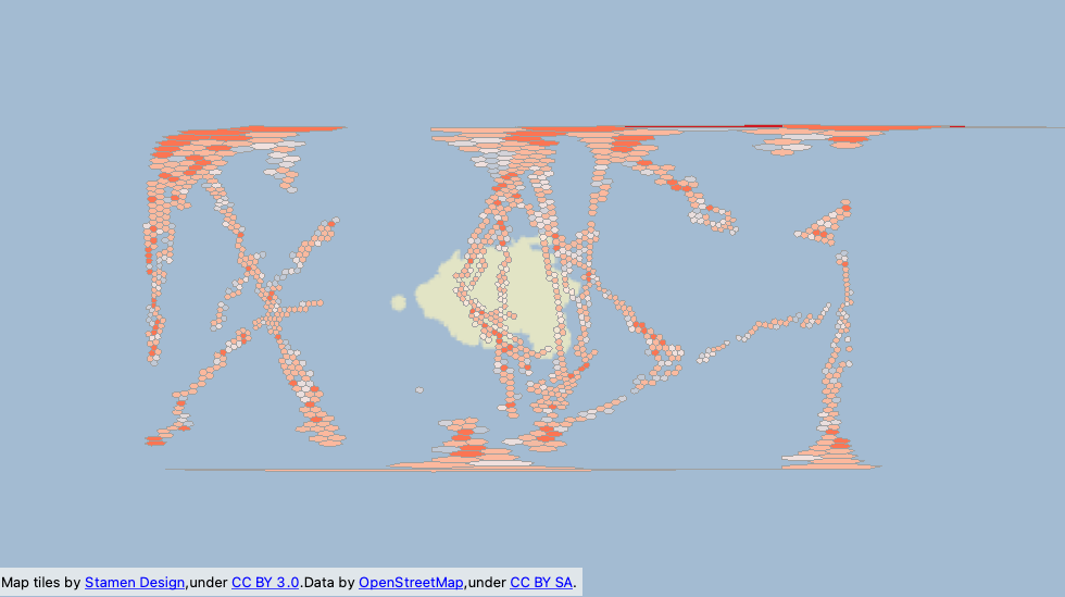
Followed the example provided by @jovitaatsafe, and the workflow appears to be exactly what I need to do with my data, where I have a number of points in different areas, and want to aggregate by count into hexagons.
The hexagons are also showing up in the ocean near Africa, so I'm guessing this is a map projection issue? But not sure where to resolve it exactly.


