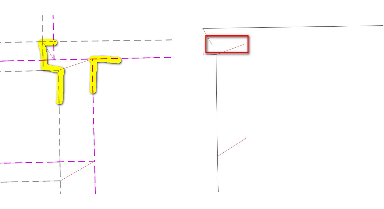
Hi there. I'm preparing our GIS data to adjust to align with new cadastre boundaries when our state mapbase is updated as part of the Digital Cadastre Modernisation. So far with testing it all looks good, but I see one polygon on one the layers has disappeared in the shifted version. On investigating it looks like the adjusted parcel this features sits on looses a few vertices in one corner and the shift vectors being used possibly cause a self intersection. I've attached the example. On the left, the grey is the current parcel boundary and the purple is the shifted, with the shift vector joining.

On the right is the particular layer that aligns with the boundary that is disappearing post shift. You can see the shape of the parcel changes and it looks like the shift vectors would cause a self intersection. Just wondering if there are any ways to avoid this? I can see a record in the output data but no geometry, or an invalid geometry.2023-06-08_165152 
Thanks in advance.


Josh

You could try first extracting the points (preserve the order for later reconstruction). This should at least give you an idea on what is happening.


Another thing is to do a vertex count before and after rubber sheet to identify bad/changed geometries. Then you can perhaps just adjust these few manually post process? or, if there are many then above approach if there are many).


Either way is seeeems like you've maybe found a bug. I think the geometry here should output an invalid geometry rather than collapsing it to nothing.


Thanks for that. I was thinking along those lines. I just checked the output in SQL Server and it does appear with the self intersection. So I did a validity check in QGIS and it now appears. At least I can find these this way and manually amend post rubbersheet.


Thanks again.

Josh


I have included the GeometryValidator before the output to fix invalid geometries and now it appears. I'll still manually tweak the polygon but at least it shows.


Reply