Hello FME'ers,
I wanted to introduce another new item here, the Question of the Week. We get asked a lot of questions at Safe - whether in the community or via support - and I wanted to highlight some of the most interesting ones.Question of the Week
This question concerns coordinate systems and came to us via Live-Chat.
Q) When reprojecting, does FME have any 'tolerance' in regards to errors that may be introduced? How accurate will a reprojection be?
A) This is a great question because nearly all of us use coordinate systems, and yet reprojection can be a bit of a mystery that we're intimidated by. Let me try and simplify the process.
A reprojection in FME is carried out using one of two operations.
1) The first operation is a mathematically exact method. Typically these are reprojections within the same datum. The only "errors" in there will be due to rounding when using 64-bit math (I've mentioned that sort of computing precision issue before) but it typically affects nothing prior to the 10th significant figure.
In short, any error in such a reprojection is totally insignificant to the quality of the results.
2) The second operation involves a degree of approximation. Typically this is required when converting from one datum to another. But what sort of error does that involve? Let's see...
Firstly I open Workbench and choose Tools > Browse Geographic Transformations from the menu. Then I look for the reprojection I am doing there:
 Here I am converting from MAGNA (a Colombian coordinate system) to WGS84. I notice it has an EPSG number of 15738. So I open a web browser and browse to epsg-registry.org.
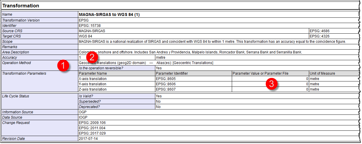
I search for 15738 and open up the relevant information:
 Firstly, I get to see the operation used. This is the method FME uses.
Secondly, I see the accuracy: 1m. So now I know the accuracy of this operation.
Actually, looking at the parameters I can see that the offsets are all zero (0)! Basically MAGNA is equivalent to WGS84 to within 1 metre, so the actual reprojection involves no actual maths whatsoever!
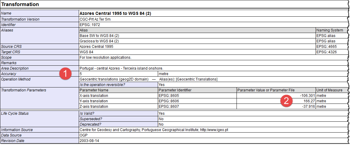
Let's look at another conversion:
 This is another simple, three-parameter calculation. This time the parameters are not zero though. Some calculations take place and the accuracy is 5 metres this time. As the scope mentions, this is "for low resolution applications". It's a great example of why you need to "know your coordinate system"!
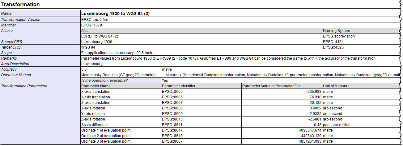
Here's a more accurate transformation:
 This one uses 10 parameters and is accurate to 0.5 metres.
But what of grid-shift files I hear you ask? Well, they are subject to the same process. Take this example:
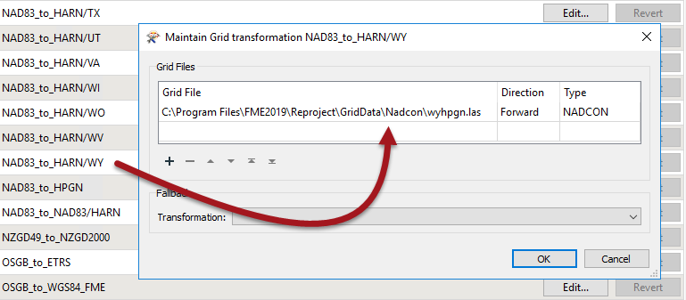
 This one has an accuracy of 0.05 metres. It uses the grid shift file shown in its parameters. Does FME use this too? Let's check. Back in Workbench select Tools > FME Options > Coordinate Systems. Locate the transformation and check its properties:
 Yes, FME is using that grid file. Notice that if the file couldn't be found, there is the option to specify a fallback transformation to take its place.
So that's a brief (and much simplified) introduction to reprojection accuracy in FME. In short, either an error will be too insignificant to mention, or there will be an accuracy that can be looked up online.
Other Notable QuestionsHere are a few other notable questions that I see from this week:
- Upgradable Transformers and FME Server
- Using Multiple String Functions in the AttributeManager
- Change to Linux Support in FME 2020
- FME Server: Receiving 1000's of JSON Payloads per Day
They're notable in that I think they cover topics that are of interest, or highlight interesting pieces of FME functionality. Basically I think you could learn something useful by checking them out.
Don't forget the Monday quiz results and keep a look out for next Monday's quiz.
Mark


