Hi,
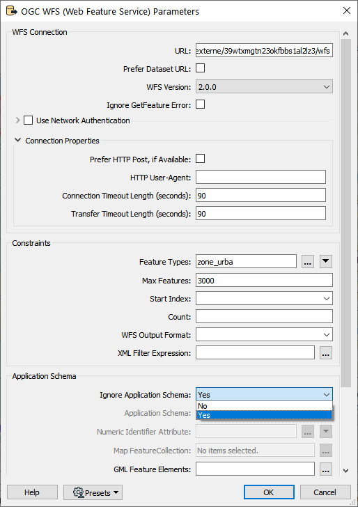
Sorry for not responding au Français, but I will keep this answer short so hopefully it is still easy to follow. A common problem is the links associated with namespaces and DescribeFeatureType. QGIS largely ignores most of this namespace and schema information and just parses the GML as it reads it. To configure FME to read WFS in this simpler mode like QGIS does, just set Ignore Application Schema to Yes as in the screen shot below. Then you should be able to read your data ok.
FME WFS Reader Settings for QGIS - like ignore application schema read mode.
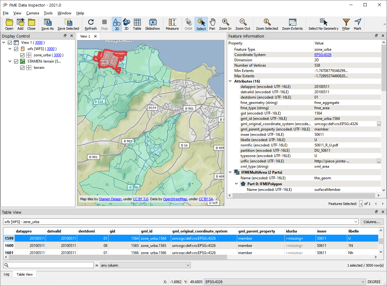
The reason why this works in your case is that it looks like either the DescribeFeatureType request or some of the namespace links needed to resolve it point to URL locations behind a firewall. Ignore schema avoids this problem. The only limitation with ignore schema is your result may not match the application schema exactly.
WFS result in FME Data Inspector
For more information see our WFS Troubleshooting guide:
https://community.safe.com/s/article/troubleshooting-wfs-errors
it still doesn't work but i see afterwards that your reader is named "ogc wfs". I can not find this reader I just have the "wfs". is it an additional module?