Hi,

I'm working with land use data derived from satellite imagery, and I've encountered a persistent issue with gaps and overlaps. I've already use TopologyBuilder and AreaGapAndOverlapCleaner transformer in FME, and while they've resolved some areas effectively, there are still instances where gaps persist, and some areas have been unintentionally cut off.

I've experimented with reducing the tolerance values, but the problem persists. Has anyone faced similar challenges, and do you have any suggestions or alternative approaches to address this issue effectively?

Your insights and expertise would be greatly appreciated!

Hi @vishnunv2696​ ,

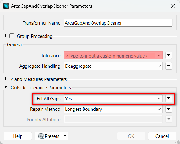
Depending on the data conditions so it's hard to say what works for you without seeing the actual data, but I think it's worth to try setting Yes to the Fill All Gaps parameter of the AreaGapAndOverlapCleaner, if gaps are remaining is the major issue.

areagapandoverlapcleaner-parameters

Hi @Takashi Iijima​,

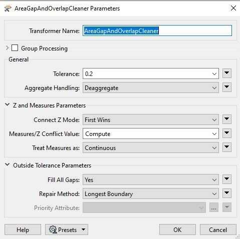
Now, I have enabled the fill all gaps and set the tolerance value to 0.2 in the AreaGapAndOverlapCleaner, and it is now working successfully. Thank you for your reply.Screenshot 2023-12-03 114509


An additional transformer that would be worth checking out is the AreaAmalgamator


An additional transformer that would be worth checking out is the AreaAmalgamator

Okay, I will check. Thank you for your reply.


Reply