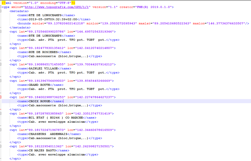
Hi,

I am new to FME, I am using FME 2019 version.

I am trying to smallworld data to google maps. My smallworld data is in Belgium Lambert coordinate system.
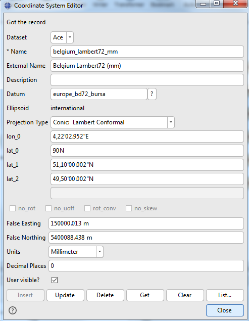
 

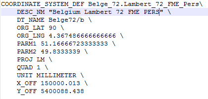
I have created a new custom coordinate system(by referring Belgium Lambert Meter coordinate system) in FME. I am using this coordinate system in the reader
I am exporting in .GPX format.

In the writer I am using EPSG:3857 coordinate system for projecting it in google maps.

But the data is displaying in arctic circle but not in belgium region.
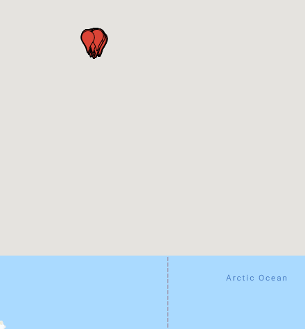
Could someone help me in getting out of this problem.

Thanks in Advance.

Regards,

Raja.


In the writer, the format is .GPX format


In the writer, the format is .GPX format

GPX files store coordinates as WGS84. If you import a gpx into google maps it will assume this


Hi @rajask132,


In the FME coordinate system definition, the X_OFF and Y_OFF should be defined in the units used in the definition, which is millimeters in your case. Please try changing the offsets in your definition to:

X_OFF 150000013 \\

Y_OFF 5400088438


Hi @rajask132,


In the FME coordinate system definition, the X_OFF and Y_OFF should be defined in the units used in the definition, which is millimeters in your case. Please try changing the offsets in your definition to:

X_OFF 150000013 \\

Y_OFF 5400088438

Thanks Dave. It is working fine now. Thanks for the help..


Reply