Hi,
I have a problem that I can't figure out how to approach. I have polygon Shapaefiles of fields on a farm over a number of years (one file per year) with attributes specifying what crops are grown on each field that year and a unique ID for each field.
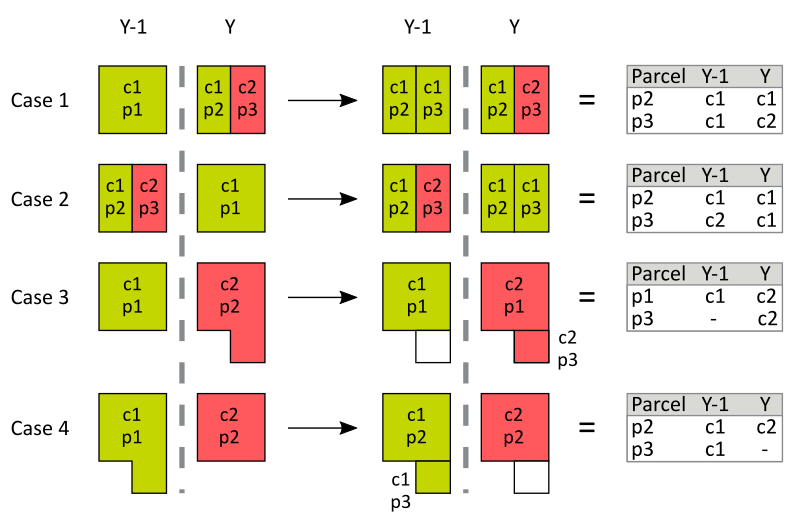
I would like to merge these into one file where each field has an attribute for each year specifying the crop grown.
The problem is that the fields are not constant over time. Exemplified in the fig below. A field may be broken up into multible fields (case 1) or the oposite merged into a bigger field (case 2). The fields may also change in size and/or geometry (cases 3 and 4). The fig also tries to illustrate the result I am looking for. If the geometry changes according to these cases the fields generally recieve new ID:s.
Any ideas on how to approach this problem?
 p=field, c=crop
Best,
Johan


