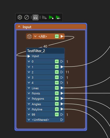
In the above image, I read a text file that contains lines of data where specific lines that start with an ID relate to different features.
In the #1 category it contains the projection information but I want to be able to set the projection of the other output ports based in the information in that line.
How do I hold and set the projection of the Lines, Points, etc?
I was thinking that I may just need to read the text file twice, once to get the projection from Port #1 and then have a feature reader that can then set the projection before processing the other output ports.
Is there a more efficient way of doing it?


