
Hello everyone,
I'm trying to create a automatization of the Viewshed geoprocessing (a raster and a shape file in input and a raster in output) from Arcgis in FME (because its ModelBuilder doesn't work as well). But I didn't find any transformer or python script by Python Caller about it. Have any ideas or tips for me about how can I do exactly the viewshed geoprocessing but in FME ?
thanks !
Best answer by hkingsbury
View original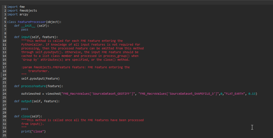


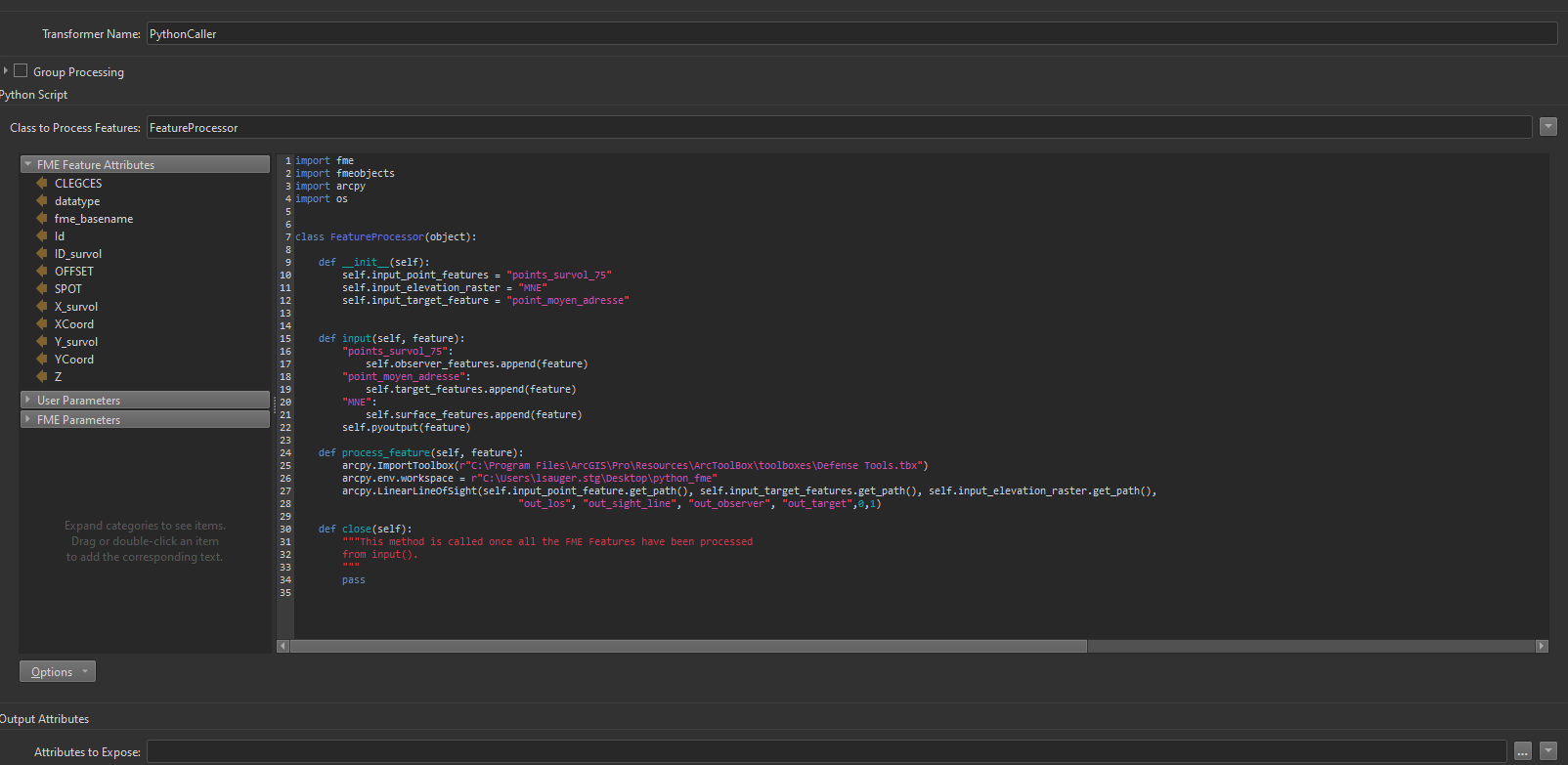 But I don't know what its need in addition to get it work.