I have a MHWS and along the MHWS line the elevation from the DEM varies. I want to locate the 2metre elevation point relative to the MHWS Line. Could you please suggest an approach that would work to identify this and convert to a line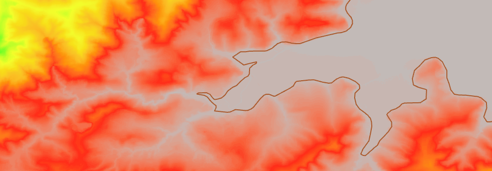

How to add 2 metre elevation offset to Mean High Water Spring
 +3
+3


Userlevel 5
 +29
+29
- Celebrity
- 1108 replies
-
19 January 2023

Thats a really interesting problem. My initial thought would be:
- Add points every X meters along the MHWS (depends what resolution you want), make sure they're numbered in order
- Overlay these points on the DEM, you now know, for points every Xm what elevation it is on the DEM
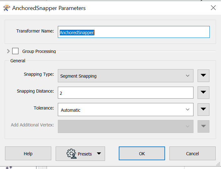
- Then, using an AnchoredSnapper (segment snapping) snap those points to the +2 elevation
- Rebuild the line
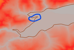
One thing to be cautious of is how will this behave with (from the inland side) with very concave angles
+3
Thats a really interesting problem. My initial thought would be:
- Add points every X meters along the MHWS (depends what resolution you want), make sure they're numbered in order
- Overlay these points on the DEM, you now know, for points every Xm what elevation it is on the DEM
- Then, using an AnchoredSnapper (segment snapping) snap those points to the +2 elevation
- Rebuild the line
One thing to be cautious of is how will this behave with (from the inland side) with very concave angles
Should this work with just points and raster? I have converted line to points and extracted value from DEM to point for those point. When I try anchored snapper against the DEM it doesn't give me any values.
+3
Should this work with just points and raster? I have converted line to points and extracted value from DEM to point for those point. When I try anchored snapper against the DEM it doesn't give me any values.
Userlevel 5
+29
- Celebrity
- 1108 replies
-
25 January 2023
Should this work with just points and raster? I have converted line to points and extracted value from DEM to point for those point. When I try anchored snapper against the DEM it doesn't give me any values.
I realise now I didnt add in one rather important step; convert the DEM to contours and use that to snap the points to - sorry!
+3
Should this work with just points and raster? I have converted line to points and extracted value from DEM to point for those point. When I try anchored snapper against the DEM it doesn't give me any values.
Ok that makes sense. Thanks for your help
Reply
Enter your username or e-mail address. We'll send you an e-mail with instructions to reset your password.